Lower Kern
Download the #1 app for rafting the Kern River
Southern California, USA
Kern River Rafting Guide
When the weather warms up the water knob gets turned and the Lower Kern begins to flow. In regular years the season is from May through August. Isabella Lake is relatively shallow, which means that by the time outflow is underway, the water temperature is comfortable and not frigid. Top to bottom this river section is straight forward class II through IV, with one portage around a Class VI, the Royal Flush.

This guide was written by Kern River Outfitters. Kern River Outfitters runs half, full, and two-day trips on the Upper, Lower, and Forks of the Kern. They have more five star reviews than any other rafting company in California. Learn more about them here.
River Info
The Jungle Run is a challenging class II and III run that uses one of the higher upstream put-ins, such as Slippery Rock or Granite, and takes out at Miracle. It is generally done as a half day.
The Miracle Run is the most popular section as it encompasses all of the Class IV whitewater and is of decent length, ending at the final take out at Democrat. It is generally run as a full day.
Finally, the Big Five is a fast trip starting at Delonegha Bridge and taking out at Democrat, with five Class IV rapids. As an added bonus, it starts below the Royal Flush, eliminating a portage. It is generally done in a couple hours.
Safety
The Lower Kern is an intermediate to advanced river run. While there are sections that are mellow Class II and III, take into account numerous other challenges such as strainers, and sieves. As a private boater, make sure you join a party that has recent Lower Kern experience.
Permits
A Kern River Use Permit is required year round for each craft (kayak, raft, etc). These are free of charge. Learn more here.
Royal Flush
Royal Flush is a Class VI rapid located at mile 12.73. The portage is on river right. There is a small sign alerting you to the portage just upriver of it on the right bank. The portage is fairly easy and doesn’t take much time at all.
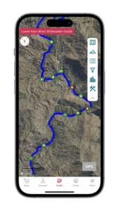
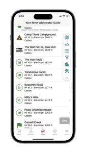
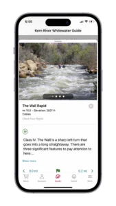
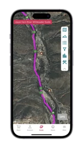
Rafting the Lower Kern? Our Kern River guide has you covered: 214 Waypoints | Live, Offline Location | 100 Photos
$9.99 – Powered by FarOut
4.8★★★★★ 23K+ Reviews
Jungle Run – Class II and III
The Jungle Run is a Class II and III run from the higher put-ins such as Slippery Rock or Granite and winds its way through the canyon to either Sandy Flat or Miracle as the takeout.
Mile 0.00 – Slippery Rock Put-in:
River Right. This put-in is open if the water is above 600 CFS. Owned by the Division of Boating and Waterways (DBW), this put-in is the furthest upstream access on the Lower Kern. The unloading area can fit two vehicles. If you are going to use this access be sure to unload quickly and move your vehicle to the upper parking lot to make room for other boaters unloading. Keep in mind, you do not want to use this put-in if flows are below 600 CFS. Learn more about Slippery Rock Put-in.
Mile 0.05 – Slippery Rock Island:
Mile 0.05 – Slippery Rock Island: The river splits around an island immediately below the put-in. Stay to the left.
Mile 0.06 – Above Keyesville Rapid:
Mile 0.06 – Above Keyesville Rapid: Class II. The river pushes into trees on the right side and it can be hard to see where to go here. Stay left and the channel will become more apparent as you approach.
Mile 0.07 – Keyesville Campground:
Mile 0.07 – Keyesville Campground: BLM dispersed camping flanks river left and river right here for the next mile or so.
Mile 0.08 – Keyesville S-Turn:
Mile 0.08 – Keyesville S-Turn: Class II. There is an S-turn that develops here. If you’re not paying attention, you may get pushed into the bank on the right side. Stay left-of-center and all will be well.
Mile 0.60 – BLM Put-In “A”:
Mile 0.60 – BLM Put-In “A”: River Left. Put- in A is a developed put-in on BLM land with a bathroom and a turn around large enough for a bus pulling a trailer. This put-in a good option for busy weekends when Slippery Rock is full. To find the put-in take Grey Pines Cuttoff Road from the 155 just downstream of the bridge where the 155 crosses the Lower Kern River. Follow this dirt road downstream along the river past a series of BLM campsites. The road is paved beginning at about 100 yards before the put-in. Keep in mind, you do not want to use this put-in if flows are below 600 CFS.
Mile 1.47 – Wallow Rock:
Mile 1.47 – Wallow Rock: Class III. At flows above 2,000 CFS, this rapid is pretty insignificant. Below 2,000 there is a huge boulder in the middle of the river with a small channel on either side. There are a couple of guard rocks on both sides that require a precise move to navigate through. Be careful as the middle boulder has been known to flip 14’ paddleboats.
Mile 1.69 – Wasco’s Wash:
Mile 1.69 – Wasco’s Wash: Class III. This is a non-rapid above 1,000 CFS. Below a grand, and you’ll want to pay attention here. Stay to the left of the rock pile and avoid the wall bottom left. It’s possible to flip at both spots.
Mile 2.1 – Granite Launch Put-In:
River Left. This launch features a metal ramp allowing you to slide your raft directly down into the canyon and onto a fabricated loading area on the river. To access the put-in, head west on Highway 178 from Wofford Heights Blvd / Highway 55 and then take the first exit labeled 42 called Bodfish and Havilah. Learn more about Granite Launch Put-In.
Mile 2.29 – Tubatulabal Indian Pictographs:
Mile 2.29 – Tubatulabal Indian Pictographs: River Right. Look river right for a glimpse of these pictographs as you float by. The Tubatulabal were the first people to inhabit the Kern and South Fork drainage. To find out more about the first people of the area visit the Nunni Cunni American Intertribal Cultural Center located on Lake Isabella.
Mile 2.7 – BLM Put-In “B”:
Mile 2.7 – BLM Put-In “B”: River Right. Highway 178 crosses the river here. This put-in is accessed by taking the road to Keysville and following the raft launch signs. This is a public access area and can get congested with day visitors. This is a day use area only, no overnight parking. Learn more about BLM Put-In “B”
Mile 2.79 – The Wind Tunnel:
Mile 2.79 – The Wind Tunnel: Just below Put-In “B” there is a long stretch of calm water up until It’s a Dilly Rapid. When the water is below 2,000 CFS, this calm pool is a great place to jump out and swim and is a favorite area for kids.
Mile 3.23 – It’s a Dilly:
Class III. This is the first significant rapid on the Lower Kern. It’s a long, splashy, fun rapid that eventually makes a gentle right-hand turn. At the second portion of the rapid stay to the inside corner on the right avoiding the Dilly hole on river left. At high flows it’s a 50-50 crashing wave, and as the water drops, it turns into an unrunnable hole. At medium flows and lower the hole looks fine but should still be avoided. Learn more about It’s a Dilly.
Mile 3.60 – Private Property:
River Left. A private beach with a home and barbeque area is located here.
Mile 3.63 – Oscar’s Nightmare:
Mile 3.63 – Oscar’s Nightmare: Class III. The river splits into two channels here. At higher flows, take the left channel as a skirt line. At medium and lower flows, you have to make the move around the large rock island by taking the right channel. Be diligent to not have swimmers above this rock island as it is a sieve. Learn more about Oscar’s Nightmare.
Mile 4.28 – Highway 178 Bridge Crossing:
From Slippery Rock put-in, this is the second bridge crossing of Highway 178. No good access is here but you could scramble to the highway if you need to exit the canyon. The next two miles are Class II and III boogie water.
Mile 5.24 – Pride Rock:
River Right. If you’ve somehow spaced out and lost count of how many bridges you’ve gone under, this Lion King rock is on river right and is an excellent reference for your location. Learn more about Pride Rock.
Mile 5.38 – Suck Nozzle:
Class II. At lower flows, Suck Nozzle becomes more pronounced. Watch for the center boulder forcing the water to go far left against the shore or far right. Take the left option. If you take the right slot your tube may get “suck nozzled”.
Mile 5.51 – S Turn:
Class II. A tree that looks like it belongs in a Dr. Seuss book is the crux of the move here. At high flows, most of the current is pushing you directly into this feature which can wrap or flip you. Carefully navigate to the left of it. As the water comes down the speed of the current slows significantly and this move is much easier to make. Learn more about S-Turn rapid.
Mile 6.27 – Black Gulch Day Use:
River Left. A sandy beach located river left that is open for day use. Accessible by dirt road from Highway 178.
Mile 6.73 – Black Gulch Surf Wave:
Mile 6.73 – Black Gulch Surf Wave: River Right. On the right-hand side of the river is a small wave that forms at low-medium flows. It isn’t the craziest surf wave, but it can be fun to hit on small crafts.
Mile 6.78 – Highway 178 Bridge.
Just upstream of the Borel Powerhouse, Highway 178 once again passes over the Kern River. There are some fun splashy waves here if you run down the center. Watch for trees on the bottom right.
Mile 6.79 – Borel Powerhouse:
Mile 6.79 – Borel Powerhouse: River Left. Now defunct powerhouse that’s owned by Southern California Edison. Learn more about Borel Powerhouse.
Mile 7.18 – Sandy Flat Campground:
Mile 7.18 – Sandy Flat Campground: River Left. Sandy Flat Campground offers 32 camping sites. Water and vault toilets are available here. Learn more about Sandy Flat Campground.
Mile 7.18 – Sandy Flat Put-In / Take Out:
Mile 7.18 – Sandy Flat Put-In / Take Out: River Left. This access point can occasionally get crowded with people swimming in this popular eddy.
Mile 7.18 – Hobo Fishing Trail:
Mile 7.18 – Hobo Fishing Trail: River Left. The Hobo Fishing Trail is a short path that connects Sandy Flat to Hobo Campground, just downstream. For most of the way, it’s very close to river level.
Mile 7.45 – Jump Rock:
Mile 7.45 – Jump Rock: River Left. Towards the end of this long pool, look river left for a pile of granite boulders. Park your rafts just past these. This jump rock has slower moving current at lower flows.
Mile 7.88 – Hobo Campground:
Mile 7.88 – Hobo Campground: River Left. A campground located upstream of Hobo rapid. There was once a hotel, store and post office located just downstream of here. Learn more about Hobo Campground.
Mile 7.88 – Hobo Rapid:
Class III. Hobo rapid was the site of a slalom kayak training course for the Olympics. No longer used but cables still run several feet above the high water line. Stay inside the first bend to avoid the pour over and then lookout for the larger holes and boulders. Learn more about Hobo Rapid.
Mile 7.93 – Miracle:
Mile 7.93 – Miracle: Class III. Located immediately below Hobo Rapid (sometimes referred to as Hobo Part II) this is a straightforward Class III with two features. First, there is a nasty rock in the center channel that comes out towards lower flows that should be avoided. And second, bottom right of the rapid there is a large rock that you can flip off of if you’re not careful. So call it good and run left down the whole thing at all flows.
Mile 8.19 – Miracle Put-In / Take Out:
Mile 8.19 – Miracle Put-In / Take Out: River Left. If you are using this as a take-out, be sure to catch the eddy on river left at the bottom of Miracle Rapid. This is the last take-out before getting to the Class IV stretch of the river. It is very hard to pull a boat back upstream if you miss this. Learn more about Miracle Put-In/Take-out
Miracle Run – Class II, III & IV. Portage Required.
Miracle is the most popular private trip on the Lower Kern as it tackles all the Class IV whitewater available and can be done in a single day. A portage is required at The Royal Flush. Keep in mind that technically this run is all the way to Democrat, however there is an option to takeout upstream at Delonegha Bridge, which is the Big Five Put-In.
Mile 8.19 – Miracle Put-In / Take Out:
Mile 8.19 – Miracle Put-In / Take Out: River Left. Drive into the Miracle / Hobo turn off from the Old Canyon Road and make a left. Go downstream as far as you can and this will take you to the put-in. Learn more about Miracle Put-In/Take-Out.
Mile 8.23 – Miracle Hot Springs:
Mile 8.23 – Miracle Hot Springs: River Left. Located on river left is Miracle Hot Springs. These hot springs can be accessed from the road/miracle campground. Be sure to rinse off before entering the springs as sand and dirt will accumulate in the pools. Learn more about Miracle Hot Springs.
Mile 8.45 – KRT Rapid:
Mile 8.45 – KRT Rapid: Class III. The river bends to the left, with numerous small, splashy waves. Enter right-of-center and work left to avoid a large wave/hole that becomes massive as the water comes up.
Mile 8.75 – KRT Loop Wave:
Mile 8.75 – KRT Loop Wave: This surf wave is open from 1,150 – 1750 CFS.
Mile 9.35 – Arnie’s Armpit:
Mile 9.35 – Arnie’s Armpit: Class III. This rapid features a tree island that splits the river. Carefully finesse your way through avoiding the trees. Learn more about Arnie’s Armpit.
Mile 9.46 – Remington Hot Springs:
River Left. On river left are a set of hot springs with cemented pools. The Old Kern Canyon Road can access these. There is a parking lot at the top of the canyon. Please be courteous to others and pack out any trash. Learn more about Remington Hot Springs.
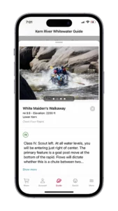
Mile 9.89 – White Maiden’s Walkway:
Mile 9.89 – White Maiden’s Walkway: Class IV. The scout of this rapid is on river left in two small eddies. Enter just right of center and fight to stay river center in order to thread the goalpost between two large holes at the bottom. Be sure not to go river right into boat flipping rock eddies and watch for sneaker holes as you set up for the goalposts. Learn more about White Maiden’s Walkway.
Mile 10.29 – Sun Up:
Mile 10.29 – Sun Up: Class II. Simple read and run rapid with two channels split by a rock shelf in the center. Left or right channel is open. There is a small wave that’s fun to hit in the right channel. At all flows this is your landmark for Sundown Falls. You’ll want to get ready to pull over on river right if you are going to scout it.
Mile 10.36 – Sundown Falls:
Class IV. The scout is on river right. The drop at the bottom of this rapid is what makes it so spectacular. At high water, you are punching through waves and riding a thin tongue of water between two large holes that block both sides of the river. At low water the drop at the end of the rapid becomes more pronounced. Learn more about Sundown Falls.
Mile 10.57 – Silver Staircase:
Class III / IV. Immediately following Sundown Falls, this is a long read and run rapid. At the top start center moving to the left. Once you pass the large pour over in the center, work back right. Learn more about Silver Staircase.
Mile 10.9 – Silver Surfer (Raft Surf Wave):
At low to medium flows a surf wave opens up on river right at the end of Silver Staircase rapid. Look for a slight pour over river right as the canyon constricts slightly. Paddle through the drop, catch the eddy on river right and from there it’s not much work to get into the pour over. The ideal flow for this surf wave is 1,000 CFS. Below this, it becomes more mellow, and eventually not retentive. Above this, there is an increasing chance of flipping or swimming.
Mile 10.99 – Buffalo Rock:
River Left. On river left at the top of the canyon is a large boulder teetering on the cliff side. Look closely and you can see a buffalo grazing. This is the start of Buffalo Canyon. Learn more about Buffalo Rock.
Mile 11.10 – Buffalo Run:
Class III. The main feature to look out for is the large pour over in the middle of the river. You can easily run right of this feature. At certain flows, this is a great hit to take but can flip a boat if you don’t hit it straight. Between Buffalo Run and Powerful Possum is a fun, technical gorge with a continuous Class II rapids. Be advised, it is possible to flip in here if you are not paying attention. Learn more about Buffalo Run.
Mile 11.67 – Powerful Possum:
Class IV. This rapid washes out at high flows, and picks up more teeth as the water levels come down. There’s a large pool upstream of it allowing an easy scout on river left. Learn more about Powerful Possum.
Mile 11.85 – Turkey Hole:
Mile 11.85 – Turkey Hole: Class II. Above 3,000 CFS, there is a hydraulic in the middle / right of center of the river that makes for a steep (flippy) surf hole. Easily avoided on river left. Below 3,000 CFS it begins to mellow out and eventually the rock creating the hydraulic emerges.
Mile 12.13 – Good Morning Eddy:
River Right. This is a decent sized eddy on river right. This is a good place to talk about the upcoming False Flush, Portage, and Royal Flush to make sure everyone is aware that they are approaching.
Mile 12.35 – Your Guide’s an Idiot Rapid / Frank Lost His Shorts:
Class II / III. There is a small hole in center of the river that is run right. This small hole has a lateral feature that can easily rip paddlers from the boat, and possibly their shorts too. Learn more about Your Guide’s an Idiot.
Mile 12.60 – False Flush:
Class III / IV. Be careful in this rapid as there is a mandatory portage just downstream on river right. Enter this rapid on river left, avoiding the large hole in the center of the river. There is a large flat rock on river left that you will need to avoid as the water pushes up against it. This rock has been known to flip boats. Once you avoid the rock T up to the drop at the bottom. At flows above 4,000 CFS, some commercial rafting companies will hike their guests around this rapid all the way to the Royal Flush. The trail for this is on river right. Learn more about False Flush.
Mile 12.73 – Portage:
River Right. There is a sign on river right just below False Flush rapid alerting you to the portage. Utmost care is required here as the portage eddy is small and can only fit a few rafts at a time. Learn more about the Portage.
Mile 12.73 – Royal Flush
CLASS VI. Recommended portage. Learn more about Royal Flush.
Mile 12.79 – Royal Flush Surf Wave:
Downstream of the portage bridge approximately 100 feet, at the conclusion of Royal Flush is a small drop with an even smaller eddy flanking it. At low to medium flows, this feature makes for a decent raft surf wave. Learn more about the Royal Flush Surf Wave.
Mile 13.38 – Razor Rock:
Class III. This rapid is pretty benign until the river gets below 1,000 CFS. At lower flows, it’s a short drop that’s known to flip boats. At flows below 800 CFS, you might want to consider portaging by parking your boat on the large flat rock to the right of the drop and pulling it over the top. Be aware that below 800 CFS, if you run this chute and try to low side through the opening, you will probably flip. The water is very quick to grab your tube. Learn more about Razor Rock.
Mile 13.59 – Taco Stand:
Mile 13.59 – Taco Stand: Class III. Read and run rapid that requires more finesse as the water drops. Learn more about Taco Stand.
Mile 14.17 – Fish Trap:
Class III. Read and run rapid. Enter center and enjoy the wave train while being sure not to get pushed left into the rocks. Learn more about Fish Trap.
Mile 14.43 – Private Property Delonegha Hot Springs:
Mile 14.43 – Private Property Delonegha Hot Springs: River Right. There are structures here and cemented pools. The presumed owners of the property are often here. Learn more about the Delonegha Hot Springs.
Mile 14.84 – Delonegha Rapid:
Mile 14.84 – Delonegha Rapid: Class III. Read and run rapid with fun punchable holes and a gentle right hand turn.
Mile 14.95 – Kern River Trail:
River Right. Next to Delonegha Bridge is the trailhead for the Kern River Trail, which follows the river. Learn more about the Kern River Trail.
Mile 15.01 – Delonegha Bridge – Big Five Put-In:
Mile 15.01 – Delonegha Bridge – Big Five Put-In: River Left. When passing underneath the bridge, there is a tree island. At flows above 2,000 CFS, the left channel is open, below that, you have to run right. Typically, this access point is used as a put-in, but you can easily finish your Lower trip here if you don’t want to run the Big Five. Learn more about the Big Five Put-In.
Big Five – Class II, III & IV
The Big Five is the final portion of the Miracle Run. Many boaters that are looking to catch an afternoon lap prefer to put-in here and run the Class IV below as there is no portage required and it is a relatively fast trip.
Mile 15.01 – Delonegha Bridge – Big Five Put-In:
Mile 15.01 – Delonegha Bridge – Big Five Put-In: River Left. This is a day use area and the put-in for the Big Five. Learn more about the Big Five Put-In.
Mile 15.74 – Surprise: Class III / IV.
This rapid is known for its exposed rock at the very bottom that can easily flip a boat at the right flows. Be sure to enter center and work your way left to avoid the rock. Learn more about Surprise Rapid.
Mile 15.76 – Surprise Rapid Surf Wave:
Mile 15.76 – Surprise Rapid Surf Wave: At lower flows, ~1,000 CFS, there is a surf wave in the Surprise Rapid wave train. Exit the rapid river left and use the large eddy to get into position to catch it. Enjoy.
Mile 16.18 – Hari Kari:
Mile 16.18 – Hari Kari: Class IV. Hari Kari is a sharp right-hand turn around a rock peninsula. At lower flows, the entrance is bony and requires precision between rocks. At medium and higher flows there is a lateral river left as you make the turn and a hole river center after you have rounded the bend. Learn more about Hari Kari.
Mile 16.45 – Horseshoe Falls:
Class IV. A long class IV rapid with a river right entrance and the main feature being a large hole river center at the bottom. The water immediately funnels into a wall marking the end of the rapid. Learn more about Horseshoe Falls.
Mile 16.58 – Horseshoe Jump Rock:
Mile 16.58 – Horseshoe Jump Rock: River Left. Immediately after Horseshoe, there is a nice eddy to regroup and take a break. The jump rock is on the upstream side of the eddy. Learn more about the Horseshoe Jump Rock.
Mile 16.97 – Sidewinder, Part A:
Mile 16.97 – Sidewinder, Part A: Class IV. This rapid is also well known as Eat Rocks and Bleed. Read and run the small holes and exposed rocks and go either left or right of the tree island continuing to read and run as you work right to set up for Part B. Learn more about Sidewinder, Part A Rapid.
Mile 17.11 – Sidewinder, Part B:
Mile 17.11 – Sidewinder, Part B: Class IV. This rapid is also known as Eat Rocks and Bleed, Bailmore, and Patchcorner. (Yes, four different names.) Enter as far right as possible and continue to work hard right through the entire curve in order to avoid the boat flipping rock pile and strong eddy on river left. Learn more about Sidewinder, Part B Rapid.
Mile 18.03 – China Garden:
River Left. This area was a dispersed campground and is now open for day use only. Learn more about China Garden.
Mile 18.20 – Turtle Pond:
This is a calm pool of water that is approximately a third of a mile long. If the water is below 2,500 CFS, Turtle Pond is a good place to have a final swim before Pinball Rapid and takeout.
Mile 18.36 – Private Property:
River Left. There is an abandoned building here and various sheds. The road connects with the China Garden pullout at the top of the canyon. As you float by, look river right and you’ll see a grove of eucalyptus trees, which aren’t found anywhere else on the Lower Kern.
Mile 18.79 – Pinball:
Mile 18.79 – Pinball: Class IV. There is an eddy river left before the rapid for a recommended scout. Enter river center and work your way through the rock garden and exit river right or left depending on flows. Your biggest concern is the entrance and some of the holes towards the bottom. Learn more about Pinball Rapid.
Mile 18.93 – Pinball Island:
Mile 18.93 – Pinball Island: There is a small island immediately below Pinball Rapid. At all flows, the left side is open. At higher flows, the right side becomes accessible as well.
Mile 19.05 – Democrat Island:
Mile 19.05 – Democrat Island: Go left of the island or you may miss takeout. This is a different island than the one that is at the bottom of Pinball Rapid.
Mile 19.24 – Democrat Takeout:
River Left. The takeout has signs warning of the downstream dam and is hard to miss along with 2 different ramps about 100 yards apart. Learn more about Democrat Take-Out.

