Arizona, USA
Black Canyon Guide
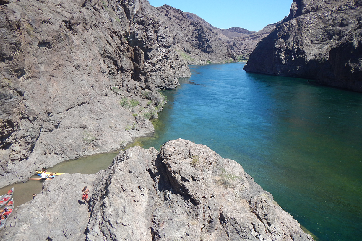
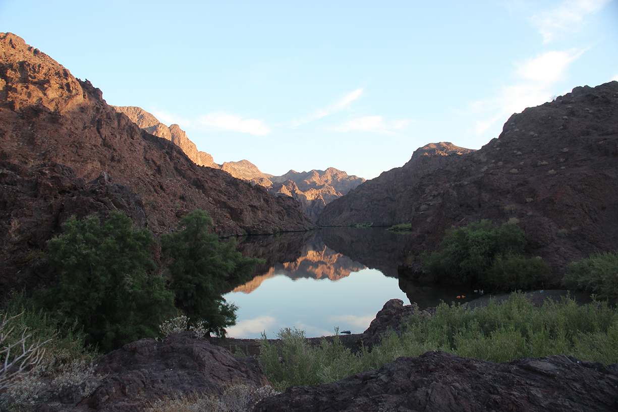
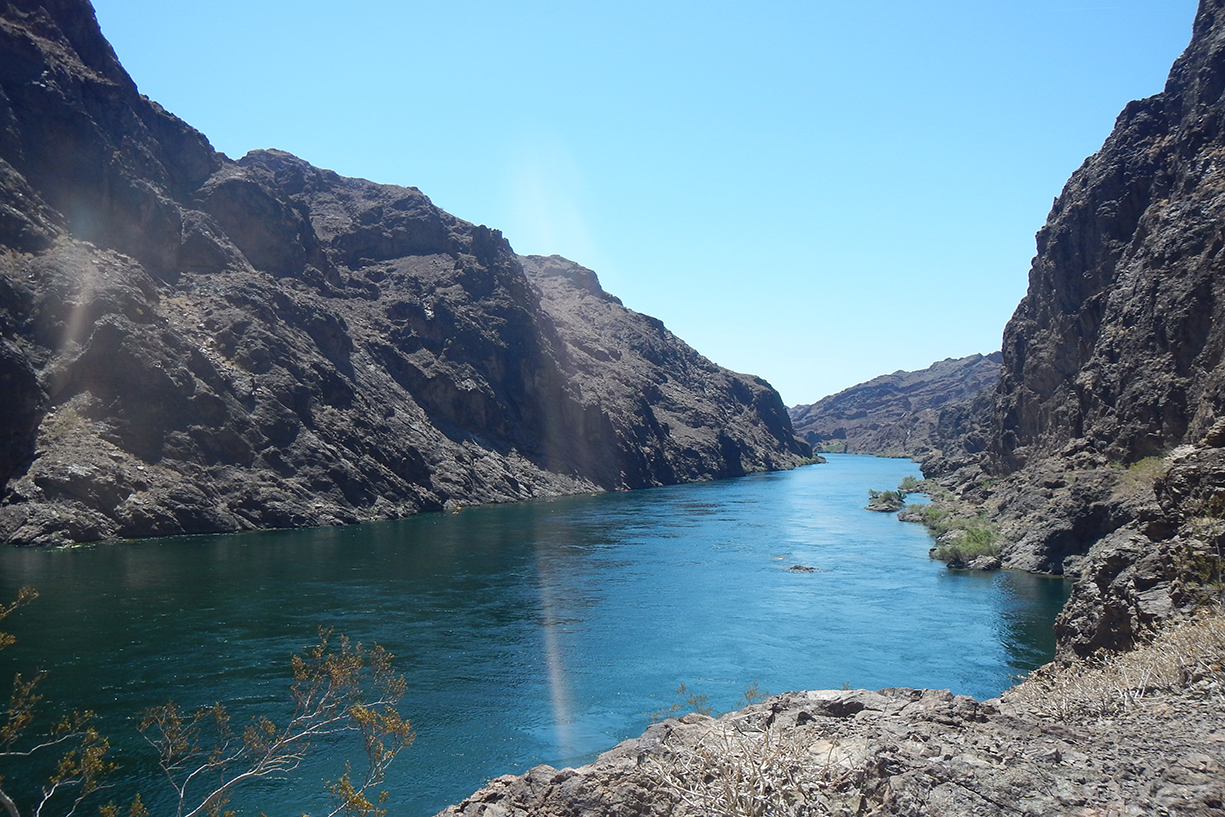
Rafting or canoeing the Black Canyon Water Trail is to experience a mixture of beauty and rich history. The entire water trail is approximately 30 miles long. The Colorado River forms the border between Nevada and Arizona along this stretch of river. River right is Nevada, and river left is Arizona. The official trail begins just below the Hoover Dam (permit required) and travels 30 miles downstream to El Dorado Canyon. This guide presents an alternate trip with no permits required. The suggested trip in this guide is to put in at Willow Beach, 11.5 miles downstream of the Hoover Dam, and to paddle upstream towards the Dam to one of many riverside campsites. From your campsite, you can float back to Willow Beach as a round trip. This trip is most commonly done on canoes or kayaks.
Blazin’ Paddles provides full-day and half-day professionally guided kayak tours so that you can safely enjoy the beauty of the Black Canyon and walk away with amazing memories of a sustainable adventure on the Colorado River. Learn more about Blazin’ Paddles.
About this guide
This guide outlines one continuous 11.5 mile stretch from Willow Beach to the mid-river restricted access sign near to the Hoover Dam. It is not legal to travel past that sign without a permit – contact the NPS for more information if you have questions regarding travel near to the Hoover Dam. Note that this guide outlines how to do this section of the Colorado without a permit. This requires paddling upstream first, with a return to take-out at the initial put-in site. The total mileage of this trip is closer to 23 miles if done as a full round trip.
All data points were collected using GPS. These locations were checked against Google Earth for accuracy. Distances are the averages of repeated trips that were GPSed.
River Info
Rafting or canoeing the Black Canyon Water Trail is a casual and scenic adventure. As you paddle you can explore lush caves, mining remnants, hot springs, side canyons, and more. Detailed information of the entire route, including regulation/permit information for those wishing to launch at the Hoover Dam, can be found here.
Safety
Upper Black Canyon of the Colorado River is a beginner run. There are important safety considerations to keep in mind, though. The water in this section of the Colorado is very cold as it is released from the bottom of Lake Mead. Beginner canoers capsize frequently in this section of river. Bring back-up layers in dry bags in case you take a longer-than-expected swim. It is crucial to always wear your PFD while on the river. The current picks up significantly in the late afternoon/evening as higher electricity demand leads to a greater release from Lake Mead for hydroelectric production. Try to paddle early in the day and afternoon to ensure the safest flows.
The extremely rare but deadly amoeba, Naegleria fowleri, is known to exist in the hot springs along this stretch of river. Despite being exceedingly rare, it is important to keep your head above water when enjoying the hot springs. More information about the amoeba can be found, here.
Permits
Launching from Willow Beach and paddling upstream (this guide) or downstream (more information here) does not require a permit. If you wish to launch at the Hoover Dam you must go with an outfitted adventure.
Paddling Black Canyon? Our Black Canyon guide has you covered: 17 waypoints | Live location | Waypoint Commenting | 27 photos
$9.99 – Powered by FarOut
4.8★★★★★ 25K+ Reviews

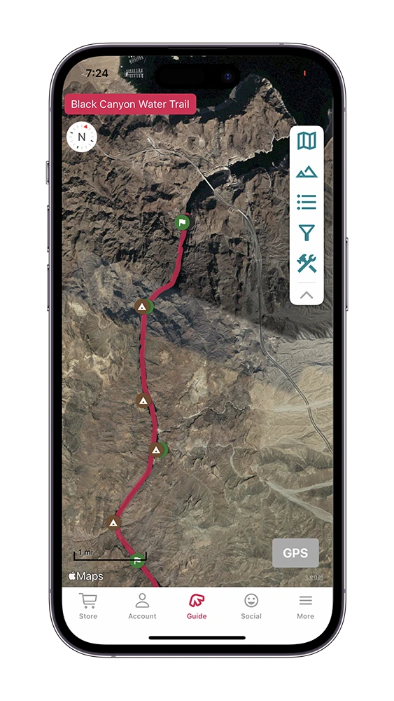
Willow Beach to Hoover Dam
Mile 0 – Willow Beach Put-In :
River left. The start of your trip! This well-stocked marina has various amenities as well as a campsite.
Mile 0.6 – Willow Beach Fish Hatchery:
River left. The U.S. Fish and Wildlife Service manages the hatchery. The hatchery intends to protect endangered species including the bonytail chub and razorback sucker. The hatchery began operating in 1962 and has been active ever since. You can take a self-guided tour of the hatchery if you pull off on river left.
Mile 1.36 – Gauger’s Homesite:
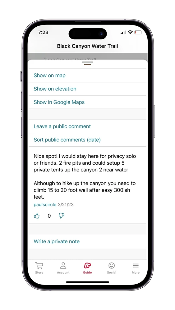
River left. Pull your boats up on the beach and start your walk. The gauge house is very nearby – up and to the left of you when you are walking away from the beach. This site contains the remains of the homesite used by the gauger that lived here between 1935 and 1939. The gauger would hike upstream along the cliffs to access the cable crossing that would take them to their gauging site on the Nevada side of the river. Make sure not to disturb the remnants of the structure if you visit this site. You can camp at the wash where you pull your canoe in to start your hike up to the gauge house. Make sure to pull your boats up high onto the beach if you are camping as the water level fluctuates throughout the day and night. ”
Mile 2.14 – Emerald Cave:
River left. Paddle into the cave. Once inside, turn around and enjoy the radiating light inside the cave. The namesake of the cave is from the beautiful emerald color that the water takes inside the cave during the afternoon.
Mile 2.32 – Gauging Station:
River right. The gauging station was built in advance of the construction of the Hoover Dam. The station was used during and after the construction to monitor water levels and silt output. The cable that runs across the river was built to provide access to the station from the Arizona side of the river. The worker who ran the gauge lived downstream on the Arizona side of the river. You can imagine how intense, and beautiful, their commute to work was.
Mile 3.96 – Cranes Nest Wash :
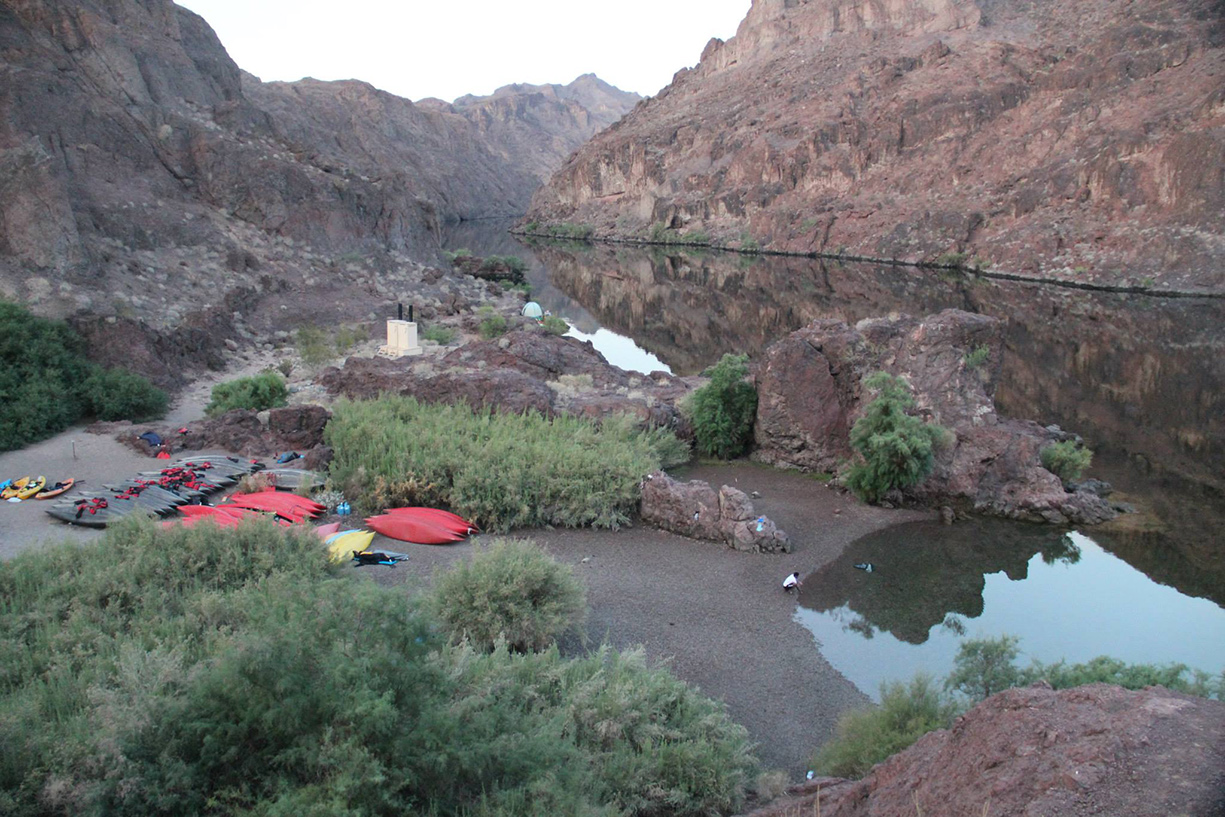
Cranes nest is an exposed yet beautiful campsite. There is a canyon worth exploring by foot from camp. Make sure to carry your boat up high onto the shore if you camp here as the water level fluctuates throughout the day and night.
Mile 4.36 – Primitive Camp #1:
River right. Pull into the wash at the foot of the canyon. This camp is exposed, and hiking is limited – so be prepared to focus on the beauty of the river if you stay here. Make sure to carry your boat up high onto the shore if you camp here as the water level fluctuates throughout the day and night.
Mile 4.69 – Primitive Camp #2:
River right. Pull into the wash at the foot of the canyon. You can explore a ways up the canyon if you decide to camp here. Make sure to carry your boat up high onto the shore if you camp here as the water level fluctuates throughout the day and night.
Mile 6.9 – Primitive Camp #3:
River right. Pull into the wash at the foot of the canyon. This camp is relatively exposed, so be prepared for the heat if you are planning on camping during the hot months. Make sure to carry your boat up high onto the shore if you camp here as the water level fluctuates throughout the day and night.
Mile 8.06 – Arizona Hot Springs:
River Left. The Arizona Hot Springs are a must-see. Excellent camping pairs with a world-class hot spring experience in this remarkable place. When you arrive at the beach, make sure to pull your boats up high. The water level fluctuates considerably at this site, and you do not want to have your boats swept downstream overnight.
Mile 8.19 – Ringbolt Rapids:
Look approximately 15 feet above the high water line and you will see large ringbolts drilled into the rock wall. These ringbolts were used in the late 1800s to winch steamboats up through a set of extremely difficult rapids. The construction of dams downstream of the rapids led to them washing out, but the evidence of their former glory remains through the presence of the bolts.”
Mile 8.33 – White Rock Canyon:
If the camping is too crowded at Arizona Hot Springs, White Rock Canyon offers a nice alternative for the night. Make sure to pull your canoes up high onto the beach if you decide to camp. The water level fluctuates throughout the day and night. You can hike up the canyon for over six miles. The hike is strenuous, and to be avoided in the summer heat.
Mile 8.74 – Primitive Camp #4:
River right. This primitive camp is a good option for a private campsite at the foot of a canyon. Carry your boats up high to avoid them being affected by the water level fluctuating.
Mile 10.01 – Boy Scout Canyon:
River right. Boy Scout Canyon offers excellent camping as well as hiking. If you are camping, drag your boats up a way into the wash to avoid issues with the water level fluctuating. For hikers, beach your craft on the sand of the river wash and get ready for a somewhat challenging hike. As you hike up Boy Scout Canyon you will be hiking alongside and through a geothermally heated creek. There is a nice waterfall along the creek as well as several small pools that you can soak in.
Mile 11.15 – Goldstrike Canyon:
River right. Goldstrike Canyon is another stellar day hike with hotspring pools, a waterfall, and beautifully colored rocks and vegetation.
Learn more about Goldstrike Canyon.
Mile 11.37 – Sauna Cave:
River right. This cave was accidentally created by construction workers involved with the Hoover Dam. The intention was to build a tunnel at the cave site, but intense geothermal heating prevented the tunnel from being completed. Access to the cave is up a steep, short hill from the shoreline. The cave is relatively straight and quickly becomes pitch black as you explore its depths. The heat from the geothermal activity becomes increasingly intense as you go deeper into the cave.
Mile 11.48 – Restricted Access:
For non-permitted trips, this sign that spans the river is the end of the line. Please respect the sign and use this as a turnaround point.