Utah, USA
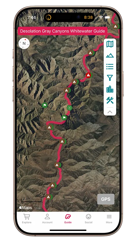
Desolation and Gray Canyons River Rafting Guide + Map
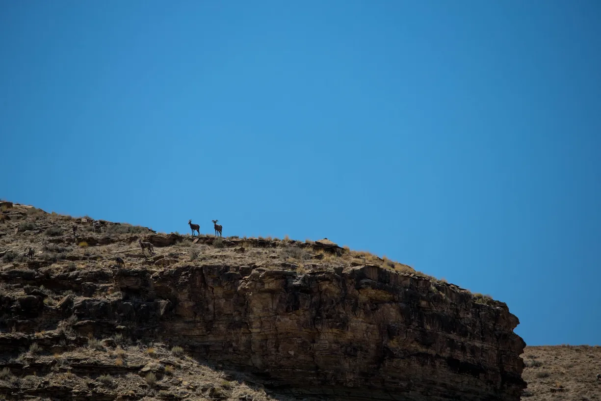
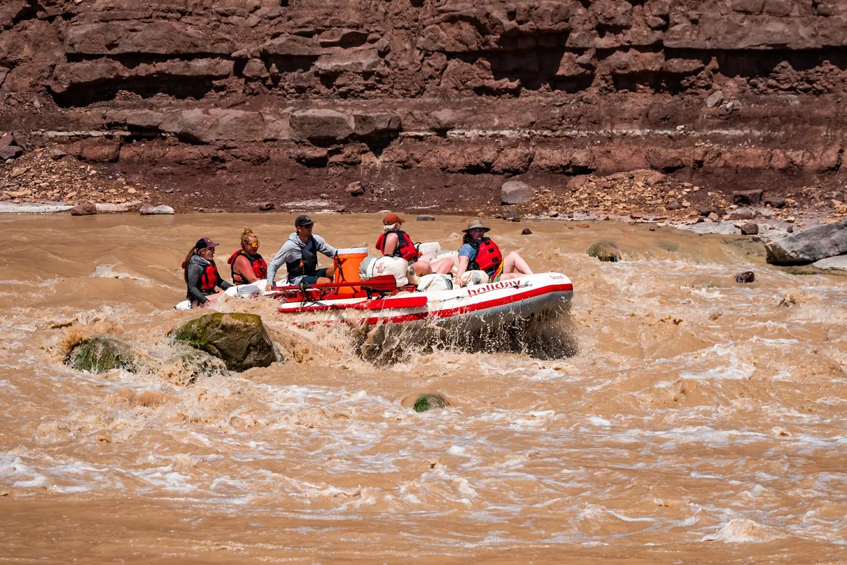
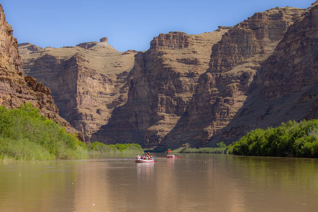
The eighty-four-mile Desolation and Gray Canyon stretch of the Green River is remote, rugged, and full of history. Wildlife abounds. The rapids are mild in difficulty. For those seeking to experience remote wilderness, there are few better multi-day trips in the US.

Rafting Desolation and Gray Canyons? Our Deso/Gray guide has you covered: 133 waypoints | Live location | 10 photos
$19.99 – Powered by FarOut
4.8★★★★★ 25K+ Reviews
IMPORTANT NOTE ON UTE LAND/RIVER LEFT RIVER ACCESS
Per Rec.gov: “As of September 2018, all activities on Ute Tribal Lands are strictly prohibited. Activities prohibited include, but are not limited to: landing water craft, visitation of cultural and historic sites, camping and hiking. The Ute Tribal Lands are on River left (ie the east side of the river) from Sandwash to Coal Creek. Please contact the Ute Tribe Fish & Wildlife Department at (435) 722-5511 if you have questions.”
Before European settlers made their way to the area, the Ute tribe was made up of three distinct bands: Uintah, Uncompahgre, and White River. They roamed freely all over Utah and Colorado, primarily as hunters. When white settlers moved in, the Utes were pushed into less desirable areas, and local wars broke out. In 1865, the Uintah band was moved to the Uintah Valley Reservation, and in 1879, the White River and Uncompahgre bands were forced onto an adjacent reservation.
Today, the Uintah & Ouray Ute Indian reservation is the second largest reservation in the US, covering over 4.5 million acres; over 50% of the tribal members live on the reservation, which operates its own tribal government.
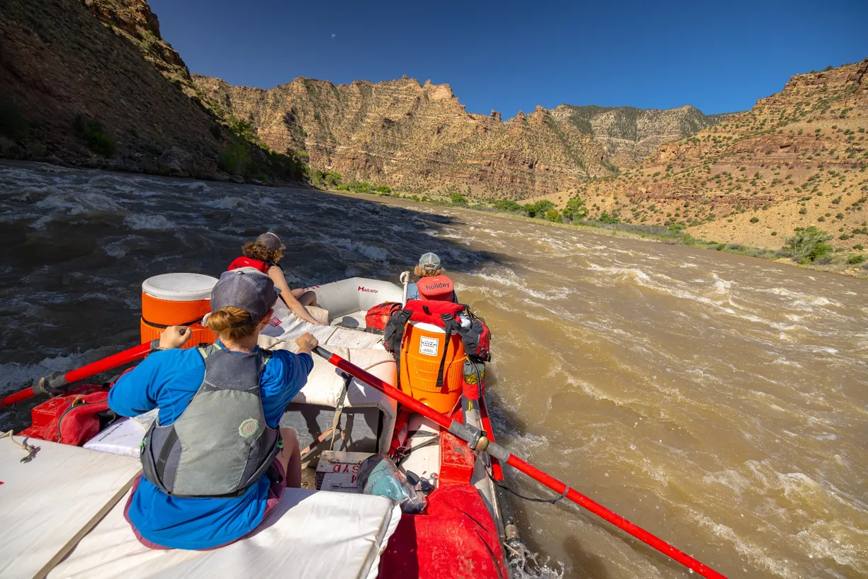
Desolation Canyon – CLass II & III
Mile 0.00 – Sand Wash Raft Launch
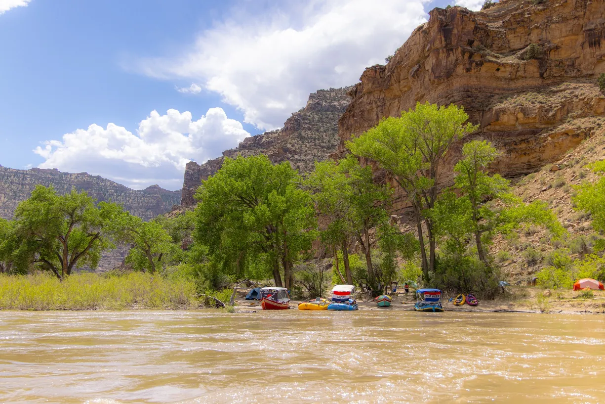
River right. The start of your trip! You can camp at Sand Wash the night before your launch date. Shelters known as “bug huts” can be reserved ahead of time and are recommended during the spring and early summer. Otherwise, campsites here are first come, first serve. Please note there is no running water and trash must be packed out.
Mile 9.1 –Tabyago Riffle :
Class I. Read-and-run.
Mile 13.7 – Gold Hole Camp #1:
River right. Medium camp. Best from medium to high water.
Mile 13.9 – Gold Hole Camp #2:
River right. Medium sized camp but larger than Gold Hole #1 and has better shade. Best at low to medium water. Vegetation can be dense, but trails and campsites are established
Mile 14.6 – Lower Gold Hole Camp
River right. Large camp. Best at medium to high water.
Mile 15.6 – Rock House Camp
River right. Large camp. Hike up the wash a bit to reach the campsites. Avoid camping in dry washes due to the risk of flash floods.
Mile 15.6 – Rock House Canyon Petroglyphs
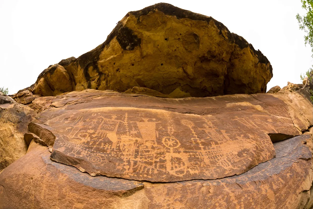
River right. Hike up the wash from camp. Once you reach the cliff, look for the petroglyph site. *Rock art is always at a sacred site to indigenous people, so please be respectful and do not touch. The oils from your fingers can change the chemistry of the images making future dating impossible.
Mile 15.6 – Rock House Rapid:
Class II. Read-and-run.
Mile 16.6 – Little Rock House Riffle:
Class II. Read-and-run down the right side.
Mile 17.6 – Opposite Stampede Flat Camp:
River right. Very small sized camp due to recent rockfall. Not viable for more than a couple of people.
Mile 18.7 –Possible sandbar camp at low water:
It is occasionally possible to camp on a sandbar that forms here at low water.
Mile 18.9 –Fossil Camp #1:
River right. Large Camp. Best at medium to high water, though it can be difficult to identify at higher water due to the vegetation.
Mile 18.9 –Fossil (or Turtle) #2:
River right. Large Camp. Best at medium to high water, though it can be difficult to identify at higher water due to the vegetation.
Mile 19.1 – Turtle fossil:
River Right. A fossilized impression of a turtle shell.
Mile 25.7 – Jack Creek Rapid:
Read-and-run. Rocks on the left side at low water. This is the beginning of the designated whitewater section of the canyon, meaning PFD’s are mandatory to wear at all times when on the water.
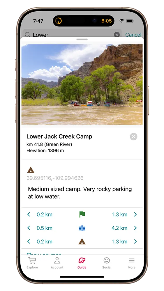
Mile 25.8 – Jack Creek Camp:
River Right. If the first camp is taken it is possible to camp farther downstream in the same area. Plan to pull over quickly after entering the rapid to make this camp, especially at high water.
Mile 25.8 – Lower Jack Creek Camp:
River Right. Shade in camp in the morning.
Mile 26.8 – Mushroom Rock Petroglyphs:
River Right. These petroglyphs from the Fremont culture are located at the base of the mushroom rock formation. The rock formation is about a quarter mile from camp. As always, please refrain from touching the art.
Mile 26.8 – Mushroom Camp:
River right. This has become a small camp due to a large cottonwood tree that splintered and fell into the river, making parking nearly impossible at high water, and very tricky at low water when a cobble bar comes out above the tree. It is still a good spot for lunch and you can access the Mushroom Rock Petroglyphs.
Mile 28.60 – Big Canyon Rapid :
Class II. Read and run.
Mile 29.60 – Firewater Rapid:
Class II. Read and run.
Mile 29.9 – Upper Cedar Ridge Camp:
River right. Large, very nice camp. The eddy here is deep and is great for swimming (or for kayakers to practice their rolls). There is a bit of a cut bank to reach the beach at low water. Use caution when camping in or near any wash, especially if there is a potential for rain.
Mile 30.1 – Cedar Ridge Camp #1:
River right. Very large camp.
Mile 30.2 – Cedar Ridge Camp #2:
River right. Medium Camp
Mile 30.3 – Cedar Ridge Camp #3:
River right. Medium Camp
Mile 30.4 – Cedar Ridge Rapid:
Class II. Read and run.
Mile 32.3 – Parking for Flat Canyon Petroglyph Hike:
River Right. This is a sacred and well-preserved site, please do not touch the petroglyphs or deviate off trail.
Mile 32.4 – Flat Canyon Petroglyphs:
River right. It is a short walk from the pull-in on shore to the petroglyphs. Enjoy the beauty and make sure not to touch. There are petroglyphs from multiple different time periods and cultures here. The trapezoidal figures and other associated markings were left by people of the Fremont Culture, who arrived in the area around 600 A.D. The more faint designs were left by the Desert Archaic people, who were primarily hunter-gatherers that predated the Fremonts and hunted with atlatls. The Fremont people were the first farmers of the region, growing corn, beans, and squash. They were semi-transient and it is believed that they did not spend all year in the canyon. The Fremont population grew by 1000 A.D., and for the next 150 years, there were more people living in the canyon than any time before or since. Evidence shows the Fremont people left the region suddenly, and it is not known where they went or why. The leading theory suggests a few seasons of serious drought made farming impossible here.
Mile 32.7 – Flat Canyon Rapid
Class II. Read and run.
Mile 32.8 – Flat Canyon Camp:
River right. Large camp. Very rocky at low water. In the spring, the stream out of Flat Canyon can be impassable, making the hike to petroglyphs impossible. There is a nice hike up the canyon to see an arch.
Mile 33.7 –Dripping Springs Rapid:
Class II. Read-and-run. Very shallow on river left at low water.
Mile 33.9 – Dripping Springs Camp:
River right. Large camp.
Mile 36.2 –Fretwater Falls Rapid:
Class II. Read-and-run.
Mile 36.3 – Fretwater Camp:
River right. Large camp.
Mile 37.2 – Upper Wild Horse Rapid:
Class II. Read-and-run.
Mile 37.9 – Lower Wild Horse Rapid:
Class II. Read-and-run.
Mile 38.5 – Undercut rock wall
Dangerous for smaller crafts
Mile 38.9 – Parking for Steer Ridge Scout:
River Left. Ute approved, stop here to scout for Steer Ridge Rapid.
Mile 39.0 – Upper Steer Ridge Rapid:
Class III. Left-of-center run. Left scout. There are many rocks in the center and right of this rapid so navigate carefully as you make your way down. New rockfall in 2022 put a sharp rock in the middle of the left channel, about two thirds of the way down. This has become the most hazardous feature of the rapid, causing wraps and tearing rubber. At medium flows, it can be very difficult to see. Typical run is to the left of it but you can go right as well, just commit to one or the other.
Mile 39.2 – Steer Ridge Camp:
River right. Large camp.
Mile 39.2 – Lower Steer Ridge Rapid :
Class II. Read-and-run.
Mile 39.7 – Surprise Rapid :
Class II. Read-and-run. There is a flat rock center-left which can be a pour-over at higher water and tough to see at low water. Easily avoidable to the right.
Mile 39.2 – Surprise Camp:
River Right. Small camp, best at lower water levels.
Mile 41.0 – Log Cabin Rapid:
Class II. Read-and-run.
Mile 41.6 – Rock Creek Petroglyphs Hike:
River Right. Four mile roundtrip, out and back hike up the canyon to an impressive petroglyph panel. Do not cross the creek, and instead follow the trail on the upriver side of Rock Creek to access the panel.
Mile 41.7 – Rock Creek Rapid:
Class II. Read-and-run.
Mile 41.7 – Fremont Petroglyph panel:
Petroglyph panel left by people of the Fremont Culture. Please do not touch!
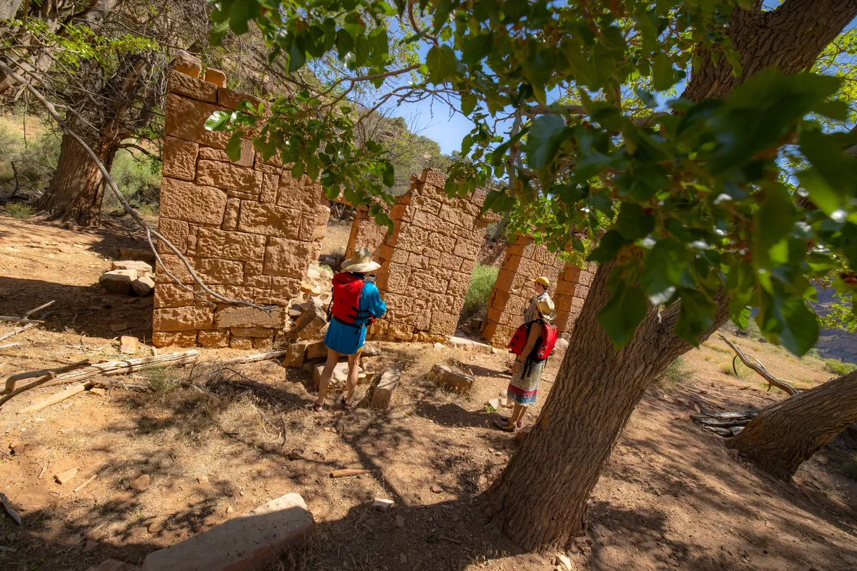
Mile 42.4 – Rock Creek Ranch:
River Right. Enjoy a visit to the historical ranch. Camping is not allowed on the ranch property or within a half mile of Rock Creek. Rock Creek Ranch was built by the Seamount brothers in the early 1900s. In the summer, they hauled supplies down Steer Ridge Canyon and spent months constructing buildings and installing fencing. When winter arrived, they left the canyon via the Price River to Woodside. Not much is known about the Seamounts, but a lot of work went into building the place. The blacksmith shop, which was the original cabin, was built mainly from logs that had floated down the river. Later, they built the rock house. Manuel and Lowella Downard bought the ranch in 1930 and hired a man named “Frenchie” do fine rock work on the back of the main house and the chicken coup. They sold the ranch in 1948, but the new owners weren’t successful and soon moved out. The current owners are the Jensen family, and the last resident was Nick Hogan who took care of the place for T.N. Jensen in the late 1970s, but Hogan used the ranch to “just get away.” He would go to Green River on horseback for supplies.
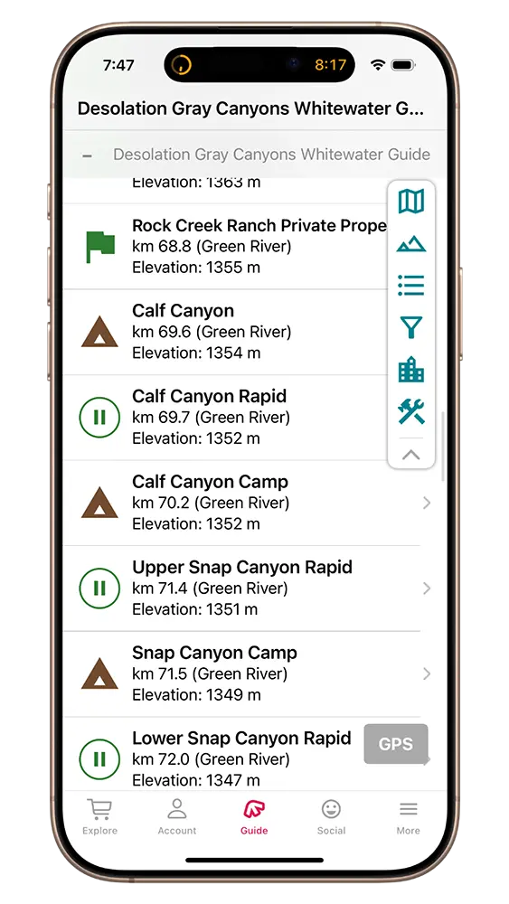
Mile 42.8 – Rock Creek Ranch Private Property:
River Right. Please do not camp here. While this appears to be an established campsite, the BLM has made it known that this is private property belonging to the current owners of Rock Creek Ranch.
Mile 43.3 – Calf Canyon Rapid:
Class II. Read-and-run.
Mile 43.6 – Calf Canyon Camp:
River right. Medium camp.
Mile 44.4 – Upper Snap Canyon Rapid:
Class II. Read-and-run. Large holes on the left at high water.
Mile 44.5 – Snap Canyon Camp:
River right. Medium sized camp.
Mile 44.7 – Lower Snap Canyon Rapid:
Class II. Read-and-run.
Mile 45.7 – Three Canyons Rapid:
Class II. Read-and-run.
Mile 45.9 – Three Canyon Camp:
River right. Large camp with a large beach at low water. This is a very popular camp where groups frequently layover.
Mile 46.0 – Three Canyons Trailehead:
River Right. Hike up to overlook and/or around the loop of Three Canyon.
Mile 46.0 – Three Canyon Camp #2:
River right. Medium size camp. Best at medium to high water.
Mile 46.2 – Lower Three Canyon Camp:
River right. Large camp.
Mile 46.3 – Overlook Destintation:
River Right. Take in a beautiful view of the river from this overlook.
Mile 47.1 – Belknap Falls
Class II. Read-and-run.
Mile 47.8 – Lion Hollow Camp:
River right. Large, sandy camp.
Mile 48.6 – Chandler Camp:
River Right. Small to medium sized camp.
Mile 48.7 – Chandler Falls Rapid:
Class II. Right-of-center run.
Mile 49.7 – Trail Canyon Camp #1:
River right. Large camp.
Mile 49.8 – Trail Canyon Camp #2:
River right. Large camp.
Mile 50.0 – Trail CAnyon Rapid:
Class II. Read-and-run.
Mile 51.1 – Above Bull Canyon Camp
River right. Large, sandy camp with shade.
Mile 51.5 – Bull CAnyon Rapid:
Class II. Read-and-run.
Mile 52.2 – Moonwater Camp
River right. Large camp.
Mile 52.8 – Moonwater Rapid:
Class II. Read-and-run. You can go left or right of the island at high water, but use the left channel at medium to low water.
Mile 52.9 – Red Point Camp
River Right. Medium-sized camp.
Mile 53.2 – Red Point Rapid:
Class II. Read-and-run. Watch out for large hole river left at high water that is a large rock at low water. Common line at medium and low water is to thread between the boulders in the middle of the rapid – watch out for rocks on the right!
Mile 53.4 – Below Red Point Camp
River right. Large camp, nice sandy beach at medium to low water.
Mile 54.2 – Joe Hutch Creek Rapid:
Read-and-run. At high water (above 30,000 cfs), there is a large hole above the rapid. At high water the typical run is center or just right of center.
Mile 55.0– High water parking spot for Joe Hutch Canyon scout:
River Right. Park here at high water for the Joe Hutch Canyon scout.
Mile 55.0– Medium water parking spot for Joe Hutch Canyon scout:
River Right. Park here at medium water for the Joe Hutch Canyon scout.
Mile 55.1 – Low water parking spot for Joe Hutch Canyon Rapid scout:
River Right. Park here at low water for the Joe Hutch Canyon scout.
Mile 55.2 – Joe Hutch Canyon Rapid:
Class III. Recommended scout. Also known as Cow Swim Rapid. Run is generally to the left of the main features before moving right near the bottom.
Mile 55.3 – Joe Hutch Camp:
River right. Large camp. Pull-in is tight – be sure to pull over immediately in the tail waves. Tough to access at high water, very rocky at low water.
Mile 56.3 – McPherson Camp:
River right. Large camp. Take the right channel around the island when possible. Island can be mucky at some water levels but is a very nice sandy beach at low water.
Mile 56.3 – Ouray Lodge and McPherson Ranch
River Left. No access (Ute land). Jim McPherson settled at Florence Creek in the 1890s. He ran a working ranch and raised a family. Initially, the family lived in a wood structure. Later, the rock house was constructed by the same stonemason who did the front part of the Rock Creek Ranch buildings. McPherson lived at the ranch until he was bought out by his son-in-law, Budge Wilcox. Wilcox ran the ranch until the 1940s when he finally sold to the Ute Reservation. The Utes built Ouray Lodge, a small hotel and general store, in the 1990’s but closed just a couple of years later. Butch Cassidy and the Wild Bunch used the McPherson Ranch as a waystation on the Owl Hoot Trail, which ran from Robbers Roost and the San Rafael River to Browns Hole. They would come in from Range Creek, up the river to Florence Creek, up Florence Creek to Hill Creek, and then north to the Uinta Basin. Joe Walker, a member of the Wild Bunch, was running from a posse so he gave his dog (that was always at his side) to a friend, John Downard, who was living at Range Creek. The posse caught up to Walker in Florence Creek while he was sleeping and shot him in his bedroll. If he had his dog with him, the dog would have awoken him and he would have at least gone down in a blaze of gunfire. He was killed Friday the 13th, 1898.
Mile 57.0 – Florence Creek Rapid:
Class II. Read-and-run.
Mile 57.7 – Jack’s Rock:
This large rock is a notable mid-channel feature.
Mile 58.5 – Above Wire Fence Camp:
River right. Large camp with lots of shade.
Mile 58.7 – Wire Fence Camp #2:
River right. Medium camp with lots of shade.
Mile 58.8 – Wire Fence Rapid:
Class III. Right or left run at high water; left run at medium to low water.
Mile 59.0 – Wire Fence Camp #3:
River right. Largest of the Wire Fence camps but the least shady. Difficult pull-in at high water, make your move early in the tail waves. Can have a decent beach at lower water.
Mile 59.2 – Three Fords Rapid:
Class III. Read-and-run, right channel. Fun wave train! Optional scout on river right. Possible undercut rock wall on river right that could be hazardous to smaller crafts. Congratulations, you’ve made it to Gray Canyon!
Gray Canyon – Class II & III
Mile 59.3 – Desolation Canyon ends, Gray Canyon begins:
Discovered by geologists in the early 1900’s, there is a geologic signature here known as the Cretaceous-Tertiary Line, or K-T Line, which indicates the global event that caused the extinction of dinosaurs roughly 65 million years ago. The leading theory of what caused what is possibly the greatest mass extinction event in Earth’s history, where 75 percent of the species on the planet were wiped out, is a meteor strike, geologic evidence of which has been found all over the globe.
Mile 60.2 – Emergency camp option at lower water:
No other viable camps after this until Range Creek. No shade.
Mile 64.2 – Range Creek Rapid:
Class II. Read-and-run. At low to medium water, take the left channel above the rapid and run the left side.
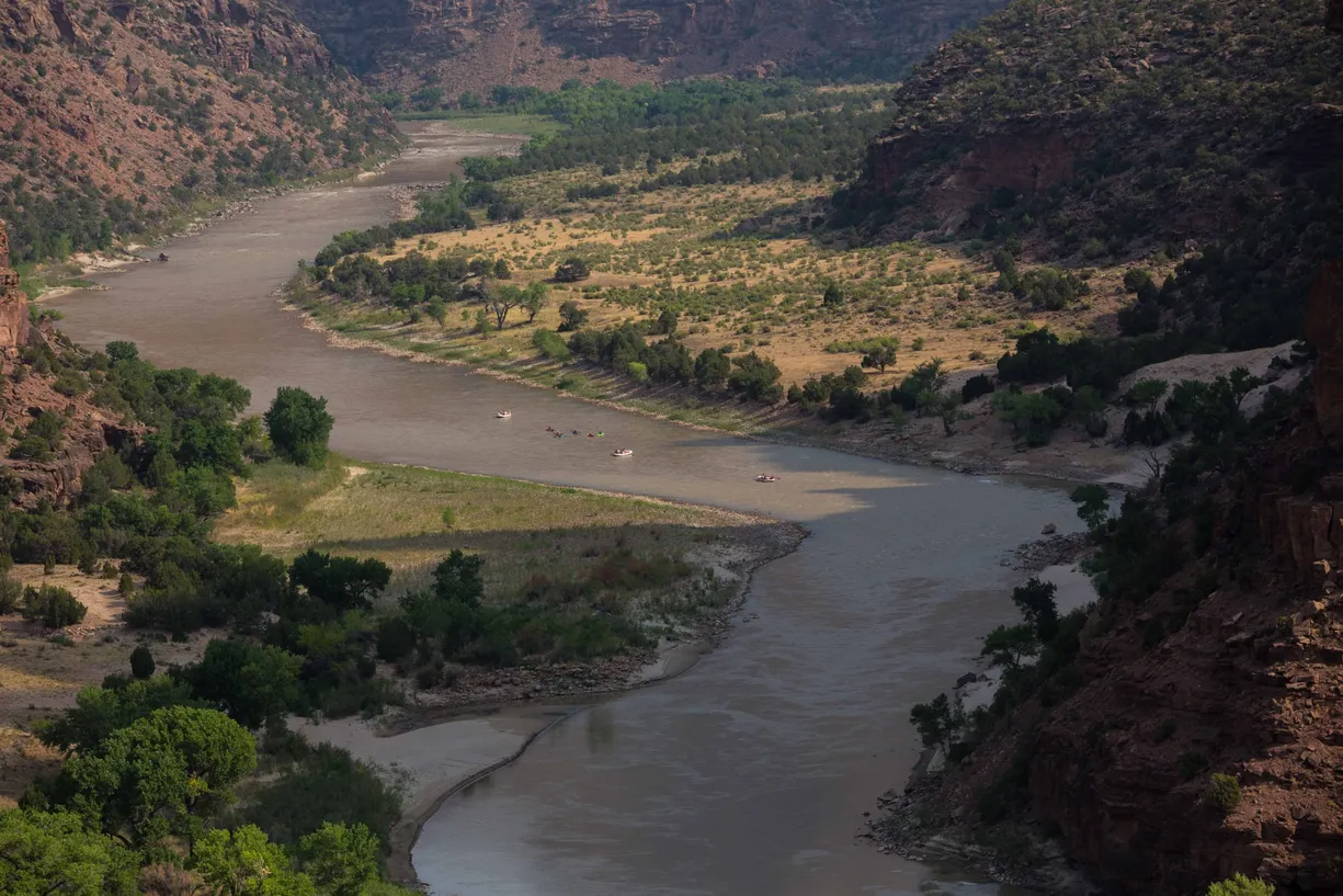
Mile 64.5 – Range Creek:
River Right. Originally settled by the Range Valley Cattle Company, the Range Creek area changed ownership a few times until the Wilcox family purchased it in 1941. The Wilcox’s operated Range Creek as a farm and cattle ranch, built the first airstrip in the canyon, and eventually began guiding hunting tours. They expanded to the Tavaputs Ranch on the plateau which still operates the hunting tours. When the Wilcox patriarch passed away, lands were divided, and the son who inherited the land in Range Creek eventually sold it to the federal government (BLM). When researchers explored the area, they were shocked to find a plethora of incredibly well preserved Fremont sites. Credit goes to the Wilcox family for preserving the sites by limiting access and installing locked gates that were monitored. The discovery gained the area worldwide attention, and ownership was eventually passed off to U of U. Research is ongoing, with over 500 sites identified. Hiking in the area is restricted, with permitted access exclusively through the north gate and only available May – November.
Mile 64.5 – Upper Range Creek Camp:
River right. This is no longer a viable camp due to a large fire. There is a layer of ash on the ground as of summer 2024. Hike is still doable from this location.
Mile 64.5 – Lower Range Creek:
River right. Sunny camp with late sunset.
Mile 66.9 – Rabbit Valley Rapid:
Class II. Read-and-run.
Mile 67.0 – Upper Rabbit Valley Camp:
River Right. Small camp. Only viable at medium to high water.
Mile 67.2 – Rabbit Valley Camp:
River right. Large, sandy camp.
Mile 67.7 – Curry Rapid
Class II. Read and run.
Mile 67.7 – Curry Canyon:
River Right. Flat Nose George Curry, an occasional member of the Wild Bunch, lived in a cave in Rattlesnake Canyon. Curry Canyon is named after him, possibly because it was used by the posse when they eventually caught up with Curry and killed him in the winter of 1899-1900.
Mile 69.0 Saleratus Rapid:
Class II. Read-and-run.
Mile 69.6 – Coal Creek scout:
River right. Park here for the Coal Creek scout.
Mile 69.8 – Coal Creek Rapid:
Class III. Right-of-center run. Large feature at the top known as “Thunderous”, can be a rock or a hole depending on water levels. Run left of Thunderous and right of the large rock below it.
Mile 69.8 – Coal Creek Overlook:
River Left. Good hike from camp. From this point on, you will begin to see camps on the left, as river left is no longer Ute territory.
Mile 70.1 – Historic Cabin:
River Left. Used by dam surveyors in 1911.
Mile 70.1 – Below Coal Creek:
River left. Late sun and no shade. Ute Tribal Land boundary is above Coal Creek, so river left visitation is permitted from here to the take-out.
Mile 70.5 – Poverty Rapid
Class II. Read-and-run.
Mile 70.8 – Poverty Camp:
River left. Large camp. Late sun and no shade.
Mile 73.6 – School Section Camp:
River right. Large camp. High bug potential due to extensive willows.
Mile 73.7 – Rattlesnake Rapid
Class II. Pull left to stay off the rocks on the right side of the river.
Mile 73.8 – School Section Overlook:
River Right. Nice hike from camp. Follow the obvious trail towards the canyon before taking a left at the fork, heading downstream and around the hillside. Carefully climb up to overlook.
Mile 73.6 – Rattlesnake Camp:
River left. Large camp. Very popular with great swimming but lots of sun. Hiking option up Rattlesnake Canyon.
Mile 75.7 – Nefertiti Rapid
Class II. Read-and-run.
Mile 75.7 – Nefertiti Camp:
River left. Large camp. There is a pit toilet, picnic tables, and road access here, so expect to see traffic and other river users.
Mile 77.5 – Petroglyph Parking:
River Right. Watch for poison ivy!
Mile 77.5 – Petroglyph Panel:
River Right. Desert Archaic. Please do not touch!
Mile 77.7 – Price River Confluence:
River Right.The Price River enters the Green from river right.
Mile 79.8 – Butler Rapid
Class II. Read-and-run.
Mile 79.9 – Upper Butler Camp
River right. Medium camp.
Mile 80.1 – Lower Butler Camp
River right. Medium camp.
Mile 80.3 – Sand Knolls Rapid:
Class II. Read-and-run.
Mile 80.3 – Sand Knolls Camp:
River right. Big sandy beach and lots of shade. Good at all water levels.
Mile 81.4 – Stone Cabin Rapid:
Class II. Read-and-run. Be careful for the boulders at the top.
Mile 82.7 – Short Canyon Rapid:
Class II. Read-and-run.
Mile 82.9 – Short Canyon Camp:
River Right. Nice camp about a mile above take out. Sandy beach at lower flows.
Mile 83.6 – Swasey’s Rapid :
Class II. Read-and-run.
Mile 83.8 –Swasey’s Beach :
River Left. Swasey’s beach featured free beach camping until a few years ago. Now, per the BLM site, “The campground consists of 12 sites, with some sites intended for large groups. The fee is $15 per night. Sites include metal fire rings, picnic tables, an outhouse, and camping pads.
Mile 84.0 – Swasey’s Boat Ramp:
River Left. Congratulations on a great trip!