Merced River
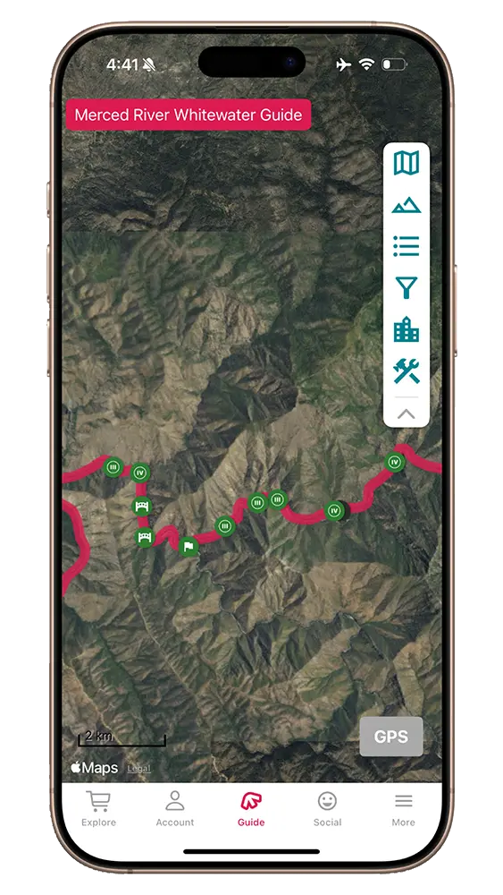
Guide to paddling the Merced River. Download the FarOut app today rapid information and live location.
Yosemite Rafting
Merced River Rafting Guide
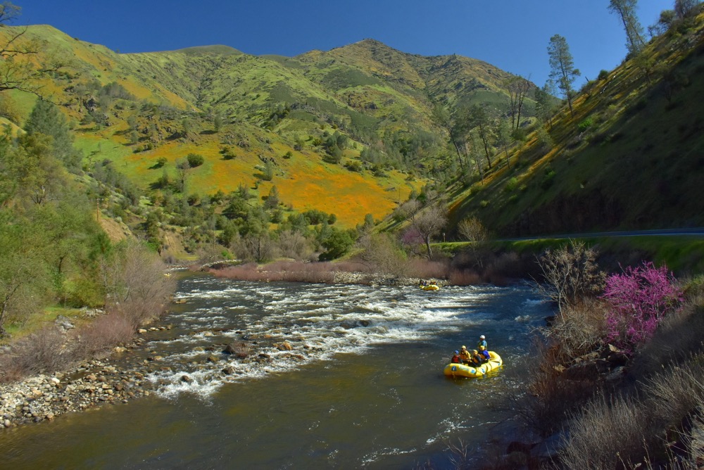
The Merced River, flowing just downstream of Yosemite Valley, carves its path through exhilarating Class III-IV whitewater. As a Wild and Scenic River, it truly lives up to its name, offering a thrilling combination of challenging rapids and stunning natural beauty. If you find yourself in Yosemite, it is well worth a trip down the Merced to get the adrenaline flowing.

This guide was written by Zephyr Whitewater Expeditions. Since 1973, Zephyr has offered whitewater rafting trips on the Merced and Kings Rivers. Learn more about Zephyr here.
4.8★★★★★ 25K+ Reviews
Rafting the Merced? Our Merced guide Has you covered.
$9.99 – Powered by FarOut
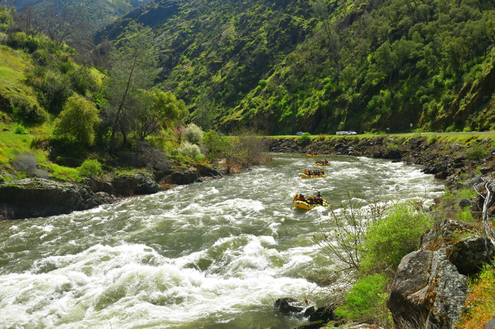
Main Merced – Class II, III & IV
The most popular section of the Merced river runs from Redbud Boat Launch to Railroad Flat. This section avoids the stout CIass IV+/V whitewater above Redbud, and the North Fork Falls portage below Railroad Flat.
Mile 0 – Redbud Boat Launch Site:
River Right. This is the furthest upstream Commercial access point. There is a good turnaround here, and a toilet. Please be courteous to other groups that may be getting ready to launch here.
Mile 1.0 – Nightmare Island:
Class IV. A large island. Both sides are passable depending on flow. Both the left channel and right channel are typically run close to the island side.
Mile 1.2 – Chipped Tooth:
Class IV. There are lines down the left or right at the top, but you’ll want to make strong moves back left at the bottom to avoid the rock wall. Strong eddy lines form here at high water.
Mile 2.2 – Indian Flat Day Use:
River Left. Commercial and Private River Access and Day Use area. There are some nice picnic tables and a vault toilet here.
Mile 2.5 – Cranberry Rapid:
Class III-IV. A shallow left to right bend marks the beginning of this rapid. Left to right laterals in the straightaway lead you into the main portion, where you want to be left of center to avoid a flippy hole. This rapid changed in 2023, taking some of the meat out of the bottom waves.
Mile 2.5 – Cranberry Gulch Day Use AreA:
River Right. Commercial and Private Boat Launch. This put in is a good option if you want to avoid running Cranberry Rapid, but it requires accessing river right via the Foresta Bridge several miles upstream.
Mile 3.4 – Can Opener (Road Rash):
Class III. Can Opener, also known as Road Rash is a fun rapid. The river sweeps from right to left around a bend, then pushes up against the old stone wall supporting the road at the bottom on river left. Fun big waves form at the bottom of this rapid at medium to high flows.
Mile 3.76 – Imitator
Class III. Fun waves in a left to right bend.
Mile 4.3 – Sticks and Stones:
Class III. A shallow rocky rapid, a classic spot to get hung up on rocks or to bump out of the raft at lower flows.
Mile 4.4 – Break Your Bones:
Class III. Similar to Sticks and Stones. The most navigable channel shifts around every few years as the cobble relocates. Both the left and the right side of the Island are passable.
Mile 4.5 – Percolator:
Class III. A large wave on the bottom left can be easily avoided against the right bank.
Mile 5.1 – South Fork Merced River Confluence:
River Left. Confluence of the Main Merced and the South Fork Merced Rivers. Both rivers are Wild and Scenic, and there is some creeky boating that can be done on the South Fork of the Merced, for the kayakers in the bunch.
Mile 5.9 – FIrst Bridge:
Highway 140 snakes alongside the river for the majority of the run on the Merced, but makes two crossings in quick succession. Here is the first of these two crossings. below Redbud access point.
Mile 6.0 – Landslide Rapid:
Class IV. The Ferguson Slide covered the road in 2006, forcing detour bridges to be installed. Much progress has occurred recently towards restoring the original highway. This rapid frequently shifts around due to the relatively fresh sharp rock from the landslide. Mind the “Room of Doom” eddy/boils on against the right wall at the bottom of this rapid at medium/high flows.
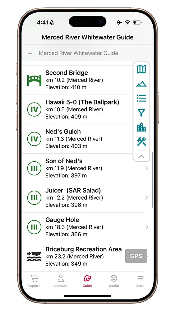
Mile 5.9 – Second Bridge:
Highway 140 crosses over again, get ready for The Ballpark.
Mile 6.5 – Hawaii 5-0 (The Ballpark):
Class III-IV. Exposed bedrock constricts the river into a fun series of waves. At higher flows this surging wave train leads into a sticky hole on right bank, and marks the start of long straightaway of fun surging waves that can flip you if you’re not careful.
Mile 7.0 – Ned’s Gulch
Class IV. At medium/medium high flows this rapid offers outstanding offset rollercoaster waves. The standard entrance is to the left of the large wave/hole at the top, though a tight right entrance opens up below 3000 CFS. Push down the middle then work towards the left to stay off of the wall.. This rapid is hard to see from the road. Road scouting requires parking in a turnout either upstream or downstream and walking along the highway. Please do so with extreme care as it is a blind corner on a busy highway with narrow shoulders.
Mile 7.4 – Son of Ned’s:
Class III+. The main feature of this rapid is a steep sharp crunchy wave on the left side. It can be run but can also flip boats when it is mean. At low flows there is a boulder bar in the middle that must be avoided, and rocks appear in the left channel.
Mile 7.6 – Juicer (III) (SAR Salad:
Class III. Juicer, a.k.a. SAR Salad features a chunky wave on the bottom left. This can be smashed into or avoided on the right side.
Mile 11.4 – Gauge Hole:
Class III. The last sizeable rapid before Briceburg Recreation Area. Most of the action can be avoided by running down the left, but there are lots of big waves to crush down the center right. Towards the bottom of this rapid, on the right bank, is Gauge Hole, a great park and play spot with eddy service. At lower flows this is a good sticky raft surf, with a good runout for any swimmers/flips. At medium/higher flows (~4000 to 7000 at Briceburg) this becomes a large standing green wave and an excellent kayak surf. Boogie boards and surfboards make an appearance here when the wave is at it’s most prime.
Mile 14.4 – Briceburg Recreation Area:
River Left. Briceburg Recreation Area offers commercial and Private River Access. There is a toilet here, and a decent turnaround spot, however, try your best to give some room to commercial trips. Just up the hill is a cool visitor center, run by the BLM, which is worth checking out while you wait for your shuttle.
Mile 14.5 – Briceburg Bridge
Suspension bridge that makes for a good landmark.
Mile 15.9 – Bikini Ledge:
Class III. A fun ledge drop on the right side leads to a nice beach on the right and popular swimming spot in the summer.
Mile 15.9 –Cable Beach:
River Right. Just after Bikini Ledge is a nice, popular beach for swimming. Great on a summer day.
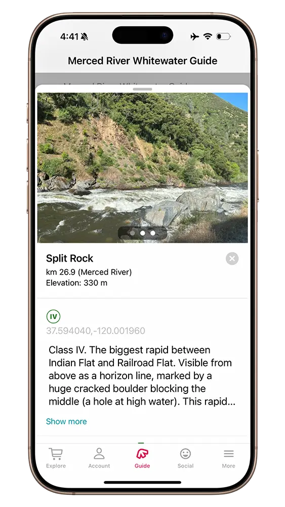
Mile 16.7 – Split Rock
Class IV. The biggest rapid between Indian Flat and Railroad Flat. Visible from above as a horizon line, marked by a huge cracked boulder blocking the middle (a hole at high water). This rapid is typically entered down the left side. At lower/medium flows you can move back center to ride out the rest of the rapid. At above 5500 the rapid starts to become a battle, with powerful surging waves and boiling currents. Consider doing what you can to stay left or right at the bottom to avoid flipping in the center lateral. At 7000+ The river pushes very quickly into Corner Pocket, with little time to clean up. Scout both rapids from the dirt road on river right.
Mile 16.9 – Corner Pocket
Class IV. The river drops to the left over a cacophony of boulders, before a small drop over a bedrock ledge. At medium flows and above (~5000+), the left side is fairly open and clean, but the river wants to push any Split Rock swimmers or flipped boats down an unpleasant ride through the right bank cobble bar.
Mile 18.9 – Railroad Flat Commercial River Access Point:
River Right. A typical takeout spot for commercial trips, and the last commercial access point before Bagby. Taking out here avoids the Class VI North Fork Falls portage, and some lake paddling, which varies in length depending on water levels in Lake McClure.