Horseshoe Bend
Guide to paddling Horseshoe Bend on the Colorado River. Waiting for the FarOut version? Join the interest list below.
Lee’s Ferry – Colorado River
Horseshoe Bend Paddling Guide
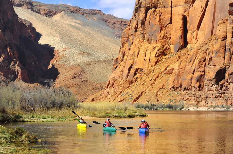
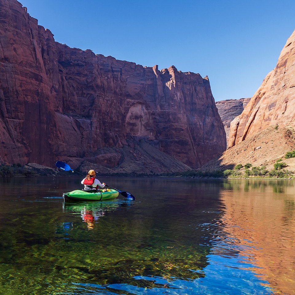
Paddling Horseshoe Bend on the Colorado River offers a unique and breathtaking perspective of this iconic geological wonder. Unlike the crowded overlook, experiencing Horseshoe Bend from the water allows you to truly immerse yourself in the canyon’s grandeur. The calm, flat waters of this section of the river make it accessible to paddlers of varying skill levels, and the towering red rock cliffs create a sense of awe as you navigate the river’s dramatic curve. 3 With options for day trips or overnight adventures, paddling Horseshoe Bend provides a memorable and serene way to appreciate the beauty of the American Southwest.
This guide was written with help from Kayak Horseshoe Bend. They offer rentals, backhaul services and loding. Learn more about Kayak Horseshoe Bend here.
4.8★★★★★ 25K+ Reviews
Paddling the Horeshoe Bend stretch? Our paddling guide is coming soon! Join the interest list below.
Horseshoe Bend – Glen Canyon Dam to Lee’s Ferry
Paddling trips are commonly completed with a backhaul, meaning an outfitter will motor you upstream, drop you off, and then you float in the mild currently back towards Lees Ferry. Mileage is descending to reflect how it’s been historically measured.
Mile 15.7 – Glen Canyon Dam
Glen Canyon Dam is a massive concrete arch-gravity dam on the Colorado River, creating Lake Powell, one of the largest man-made reservoirs in the United States. It was built to regulate the flow of the Colorado River, providing water storage and hydroelectric power to the Southwest. The dam’s construction and the resulting Lake Powell have been subjects of environmental debate, due to the flooding of Glen Canyon and the impact on the Colorado River ecosystem. From the river, you are prohibited within 1/4 mile of the dam.
Mile 14.9 – Kayak Beach
River Right. The furthest upstream drop off point for backhaul trips. Plenty of room here to get set up and push off downstream. Please note, just upstream of Kayak Beach is a closed area that is off limits annually from March 15 – September 1 for Osprey breeding season. See FarOut app for exact location.
Mile 14.1 – Ropes Trail Campsite
River Right. This is the furthest upriver campsite located on the corner of the bend at “river right” (right side of the river when looking downstream), at approximately River Mile 14 (14 miles above the boat ramp at Lees Ferry) or about 2 miles below Glen Canyon Dam. There is a very small beach at the base of a tall cut bank and a worn trail that leads up to the campsites. This campsite is about 30-feet above the river. The small beach area in front does not offer much access to the river for fishing or boat storage. This campsite offers a large camping area with some shade.
Mile 13.8 – Natural Spring
River Right. Flowing only about 18 inches through some ferns is a natural spring flowing year round.
Mile 13.6 – Powerlines
Powerlines cross overhead
Mile 13.4 – Natural Spring
River Left. Flowing through a large split in the sandstone about 5 inches wide a large amount of spring water rushes into the river. A fantastic spot for enjoying the shade on this stretch of river.
Mile 13.2 – Tractor Tire
River Right.
Mile 13.2 – Honey Draw
River Left. The current picks up the pace at this point through this riffle. The draw itself leads you to a small cove.
Mile 12.1 – The Slough
A small channel to the side of the river. This stretch of river is much warmer than the main channel of the river and has a very different ecosystem.
Mile 11.2 – Ferry Swale Campsite
River Left. Approximately River Mile 11, about 3 miles below Ropes Trail Campsite and 5 miles below Glen Canyon Dam. This is one of the more popular campsites. Expect this camp to be occupied for much of the year and often fills before others. This campsite is perfect for large groups and offers considerable beach access as well as hiking on the bench above the river. It also offers some of the best fishing access, allowing one to cover more than a mile of shoreline. It has limited shade. Large beach area.
Mile 11.1 – Ferry Swale Island & Bar
Mile 10.2 – Petroglyph Beach
River Left. At mile 10, on river left, you’ll find Petroglyph Beach. It’s well worth a visit. To reach the petroglyphs, walk about 600 feet inland from the river, past the four outhouses. A clearly marked trail leads directly to them. This is a popular drop off spot for back hauls.
Mile 9.8 – Duck Island
Small island that’s popular with fishermen.
Mile 9.1 – Nine Mile Campsite
River Right. Popular campground within view of the Horseshoe Bend view point. At the head of Horseshoe Bend at River Mile 9 about 2 miles below Ferry Swale Campground. This is a large campground offering good dispersed camping. Again, like Ferry Swale, this campground often fills first. This area offers plenty of beach and good hiking on the bench and along the river. It allows one to fish for a mile or more along the river. Has limited shade. Decent beach area with sand and gravel.
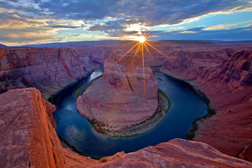
Mile 9.1 – Horseshoe Bend
The famous horseshoe bend is across the river at Nine Mile Campsite.
Mile 8.4 – Eight Mile Campsite
River Right. This campsite, located on a bench, is the least-used in the area. It offers a large, shaded space with a beach suitable for boat parking and fishing. It’s possible to hike upriver towards Horseshoe Bend Campsite.
Mile 7 – Lunch Beach
River Left.
Mile 6.5 – Six and Half Mile
River Right. 6 1/2 mile is a beautiful spot that has become a restoration project started by the National Park Service. They have come in and removed all of the invasive Tammarisk trees and have begun planting Cottonwood Trees as well as some local brush and wildflowers. This spot truly represents what the river would have looked like hundreds of years ago.
Mile 6.2 – Six Mile Campsite
River Right. 6 Mile is a phenomenal campsite. It is a smaller campsite that is very easy for powerboats to access as well as paddle sports of all kinds. This camp is also right below a layer of limestone that is very interesting, also only a short walk above the campsite.
Mile 5.6 – Six Mile Bar
River Left.
Mile 5 – Hot Tub Beach
River Right.
Mile 3.8 – Waterholes Canyon
River Left. Short hike
Mile 3.5 – Finger arch
River Left. Keep your eyes peeled on the river left canyon wall, about 1/3 of the way up for a small arch.
Mile 2.3 – 2.5 Mile Bar
River Left. This is access for Fall Creek/Echo Cliffs/Hislop’s Cave. For Hislop’s Cave, proceed 150 yards along the dry creek bed; a small cairn on the left marks the beginning of the trail. The cave is more of an overhang with a view. Keep your eyes peeled for John Hislop’s inscription, the caves namesake. John was part of the 1889 Stanton Expedition.
Mile 0.3 – Charles Spencer steamboat
River Right. The boiler of the sunken boat is visible when flows are less than 15,000 CFS, shadowed beneath the river’s surface.
Mile 0.0 – Lees Ferry Launch Site:
River Right. Your starting and ending point for this trip. We write about Lees Ferry extensively for our Grand Canyon guide which is linked below.