Rio Gato
Rio Gato waypoints and general information
Costa Rica Rivers
Rio Gato, near Turrialba
The Rio Gato is a tributary to the Pejibaye River, just outside of Turrialba.
This guide is in BETA and has limited information. Do you have any information to share about the Rio Gato? Click here to contribute.
About The Rio Gato
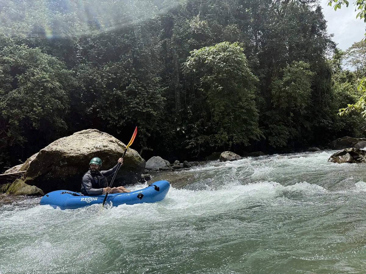
For years, while paddling the Pejibaye River, I’ve been curious about the Rio Gato, which joins the Pejibaye just before the takeout. Its waters always looked clear, and the flows seemed perfect for a packraft. With the transition from dry to rainy season underway, the water levels finally looked good enough to explore it.
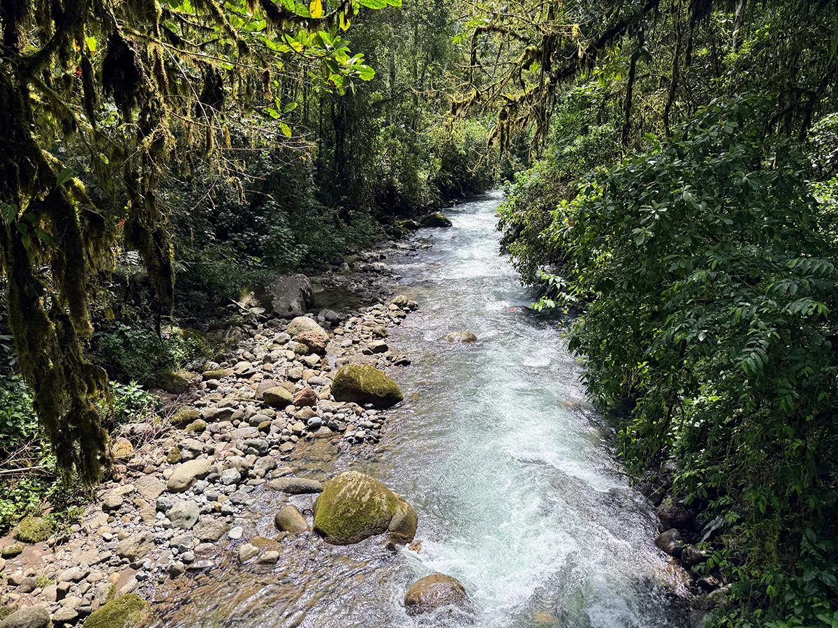
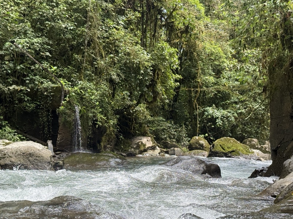
We drove as far upstream as possible, then put in. The Rio Gato immediately proved to be very technical and steep Class IV water. It features numerous boulder gardens and fun drops with challenging entrances and exits. Despite the jungle-covered canyon, we encountered no strainers, likely due to high water clearing them out. This guide provides only basic waypoints for the Rio Gato and lacks information for medium or high water levels, which you’ll probably want to avoid anyway.
Safety
As I emphasize in the Pejibaye guide, water levels can rise incredibly fast there. On the Rio Gato, this happens even more rapidly. You absolutely do not want to be on this river if it’s raining or looks like it’s about to rain.
Additionally, the river’s lines and runnable sections appear to be constantly changing. Because it’s steep, the Rio Gato is essentially miles of continuous rapids. There are dangerous spots where you could get pinned. If you plan to paddle this river, you need to be highly experienced and only go when conditions are ideal. A local farmer even told us he’d lost a cow and a dog to the river just the day before we launched. Take your time and be careful.
Rio Gato – Class III+ & IV
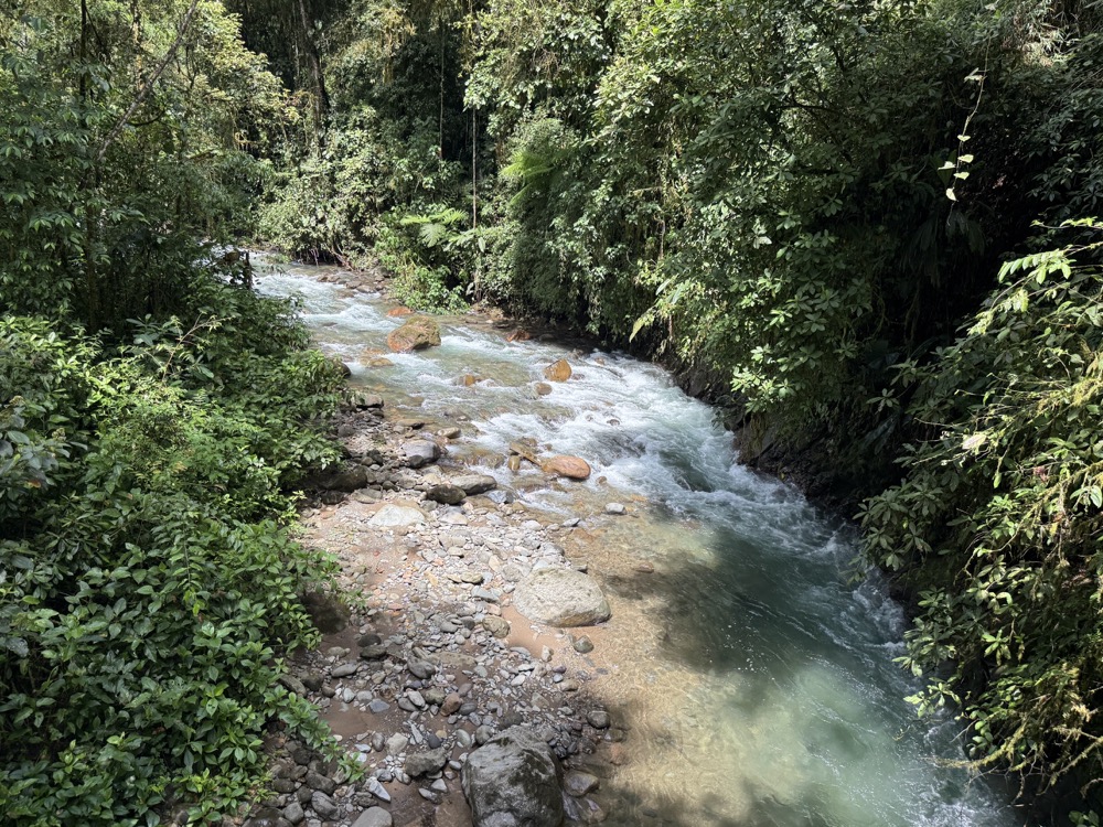
The Rio Gato starts off steep and fast and as you get closer to the confluence with the Pejibaye, the river begins to mellow out some.
Kilometer 0 – La Marta Refuge
The furthest upstream access point is located in La Marta Refuge, a famous wildlife refuge that opened in 1991. Formerly a coffee, cacao and banana farm this expansive property has lodging, camping and 15 kilometers of trails built. This is a paid access point.
Kilometer 0.1 – Rio Marta confluence
River Right. Just downstream from the put-in the Rio Marta meets the Rio Gato.
Rapids
Class III and IV from the start until a few kilometers in. On the day I paddled it the river looked like it was around 200 CFS. There is no gauge. There are calm sections between the rapids but they’re brief. Overall, the whitewater is fairly continous for most of the way. I would call it Class III+ / IV moves you have to make. We didn’t portage anything but we did get out to do some quick scouting towards the beginning of the run.
Kilometer 0.6 – Footbridge
Old footbridge crosses the river here.
Kilometer 2.4 – Big Right Turn
The river makes a noticeably dramatic right turn that at high water slams into a house sized boulder.
Rapids
A few more hundred meters of very technical whitewater
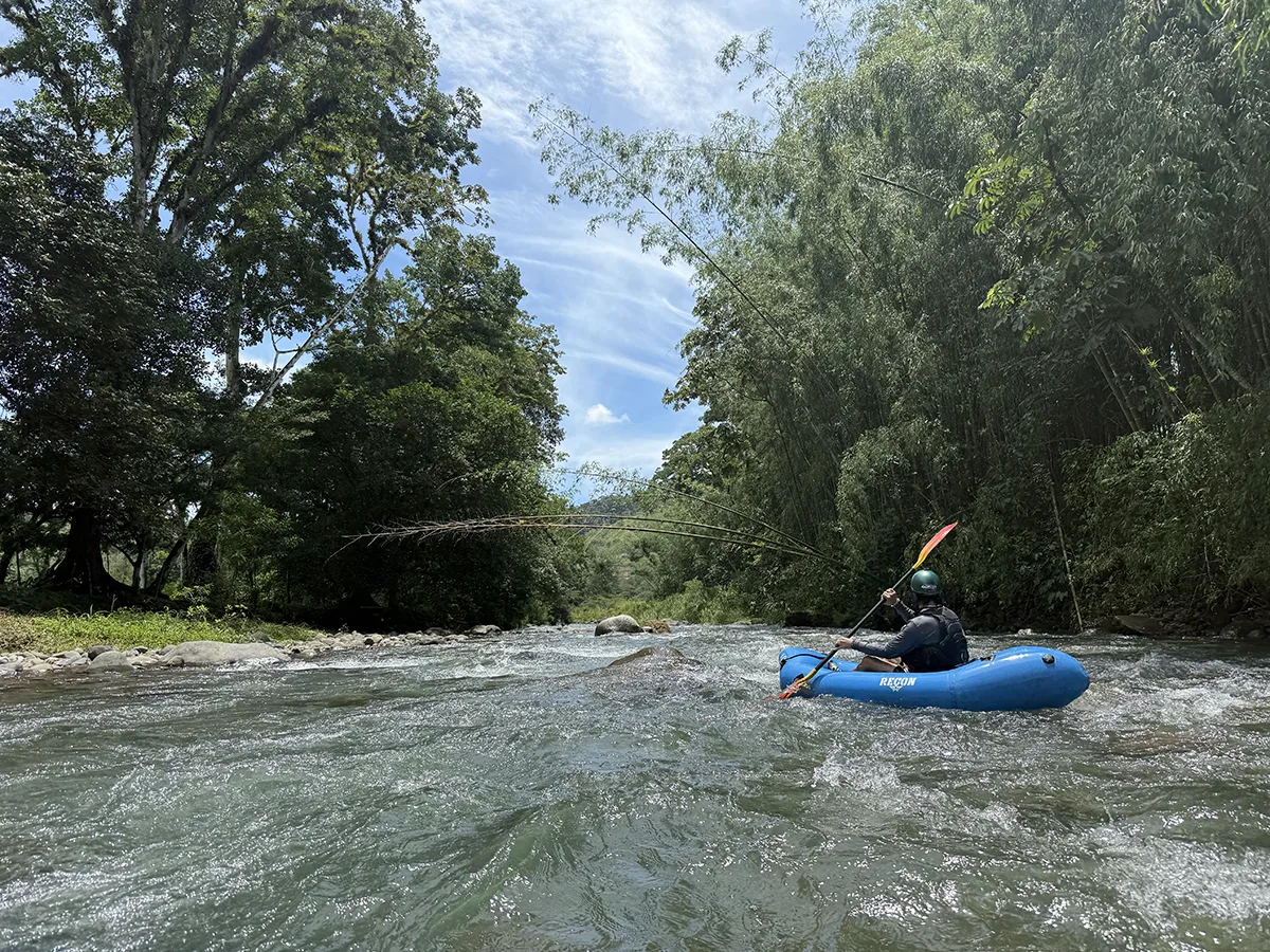
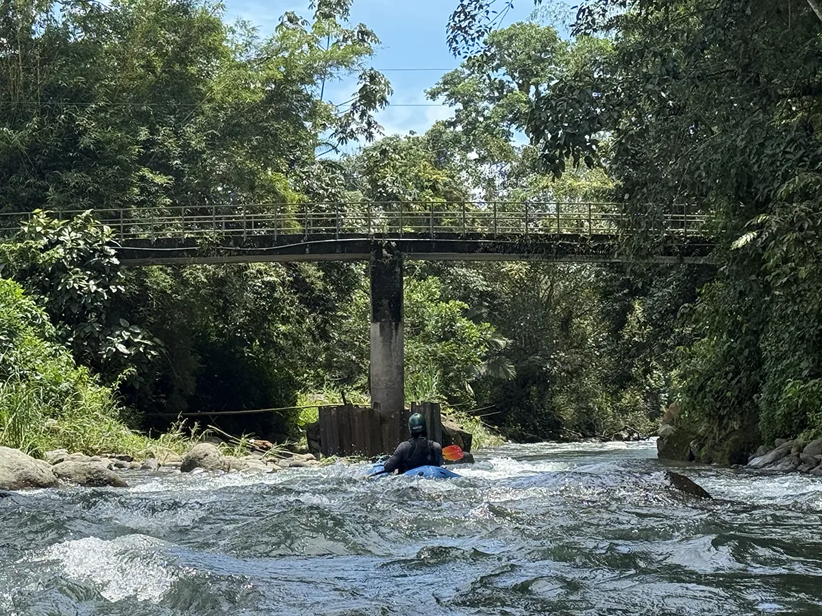
Kilometer 3.1 Car Bridge
Vehicles can cross this.
Class III Whitewater
As the river moves towards the Pejibaye the gradient diminishes and the whitewater gets a little easier.
Kilometer 5 – Pejibaye confluence
River Left. The Rio Gato ends as it meets the Pejibaye.
Kilometer 5.1 – Camino de Costa Rica Bridge
Iconic photo spot for hikers on the Camino de Costa Rica as they cross this hanging bridge.
Kilometer 5.4 – Pejibaye takeout
River Left. The 5.4 kilometers from pushing off from shore and arriving here (with a few scouts along the way) took us one hour and ten minutes.
This guide is in BETA. Help this page by adding a waypoint
Do you know this run? Submit a waypoint below.