Cache Creek
Paddling guide to Cache Creek, near the Bay Area.
Cache Creek – Bay Area, California
Cache Creek Paddling Guide
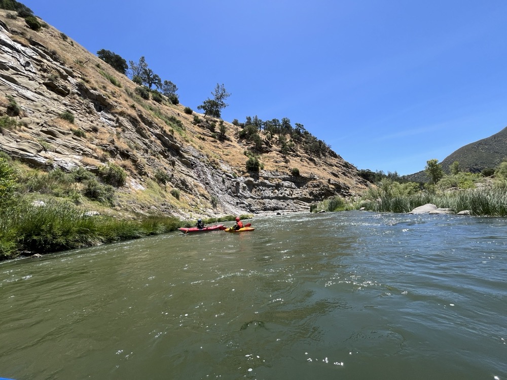
Spilling out of Clear Lake in Northern California, Cache Creek offers great solitude and excitement and is just a 2-hour drive from San Francisco. This scenic stretch offers a nice blend of Class II/III rapids experience ideal for a quick getaway trip craving a splash of adventure. With intermediate rapids, warm water, and beautiful canyon views, Cache Creek delivers the perfect balance of excitement and relaxation for a half-day or full-day summer trip. It’s dam-released, so there is typically flows throughout the warmer summer months.
4.8★★★★★ 25K+ Reviews
Paddling Cache Creek? Our FarOut guide has you covered!
Cache Creek
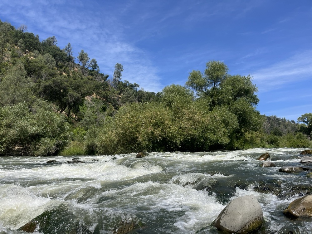
Typical summer flows on Cache Creek run between 700-1000 CFS, offering some fun, and surprising hits throughout this Class III trip. Keep an eye out for members in your party that are in an inflatable kayak throughout this run. The crux of this stretch lies at the end with Mother Rapid, a solid Class III.
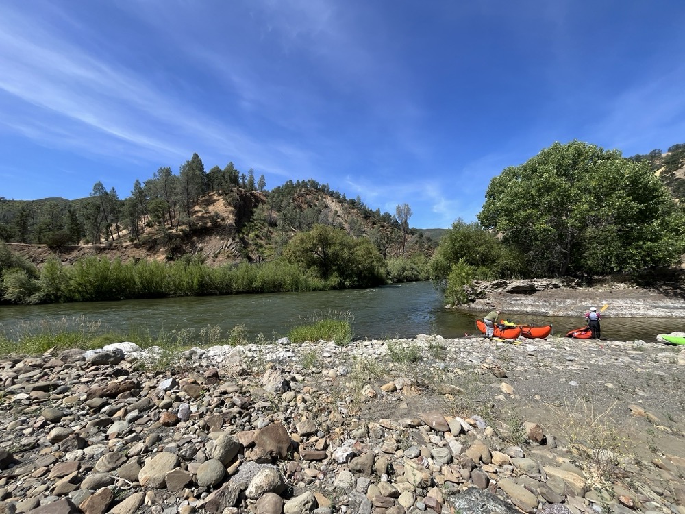
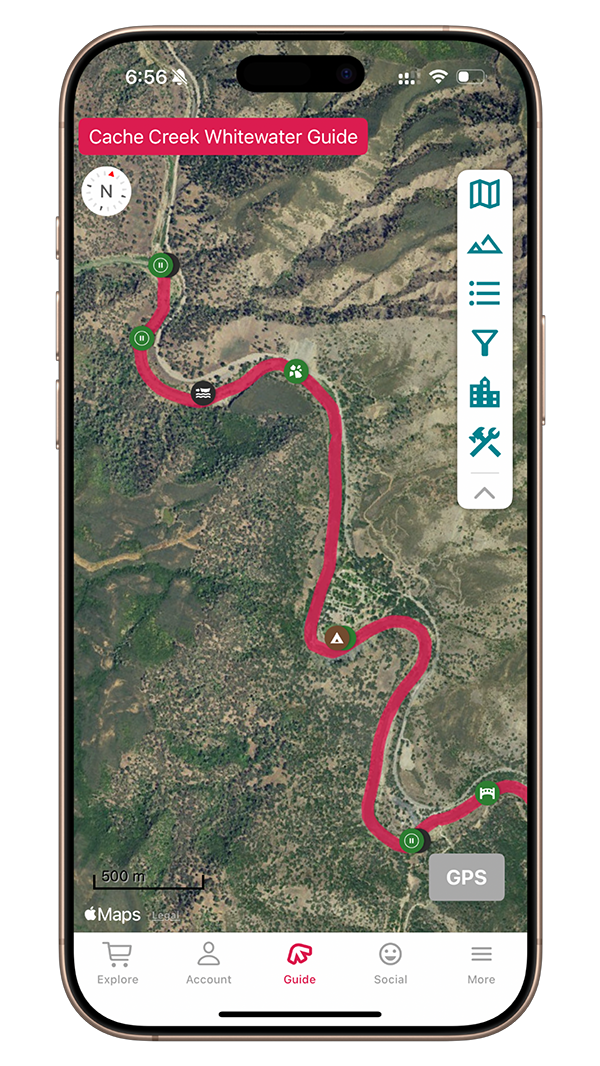
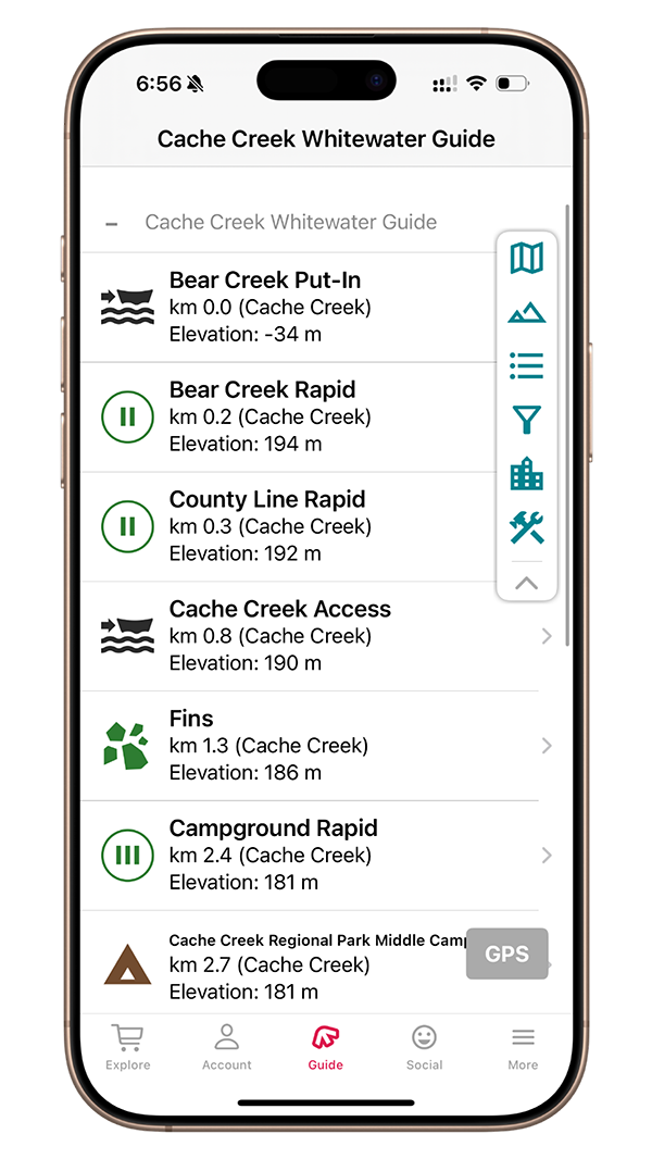
Mile 0.0 – Bear Creek Put in
River Left. Bear Creek joins Cache Creek right at the put-in. There is a shade structure and toilet here during the summer months. Just downstream of the put-in is a Class II riffle.
Mile 0.1 – BEAR CREEK RAPID
Class II. Immediately upon getting on the water awaits a shallow, Class II riffle. Find your way through, and be mindful for some trees/bushes on the left side as you get situated in your craft.
Mile 0.2 – County Line RAPID
Class II+. The river bends to the left, with some sneaky rocks on the right side. Staying left is the easy move, but the right has some fun options, including a medium wave/hole towards the end of the rapid.
Mile 0.5 –Cache Creek Access
River Left. There is an alternate put-in downstream of Bear Creek. There is a Day Use fee.
Mile 0.8 – Fins
This section features unique geology and there are some fun/silly routes to take and eddies to catch.
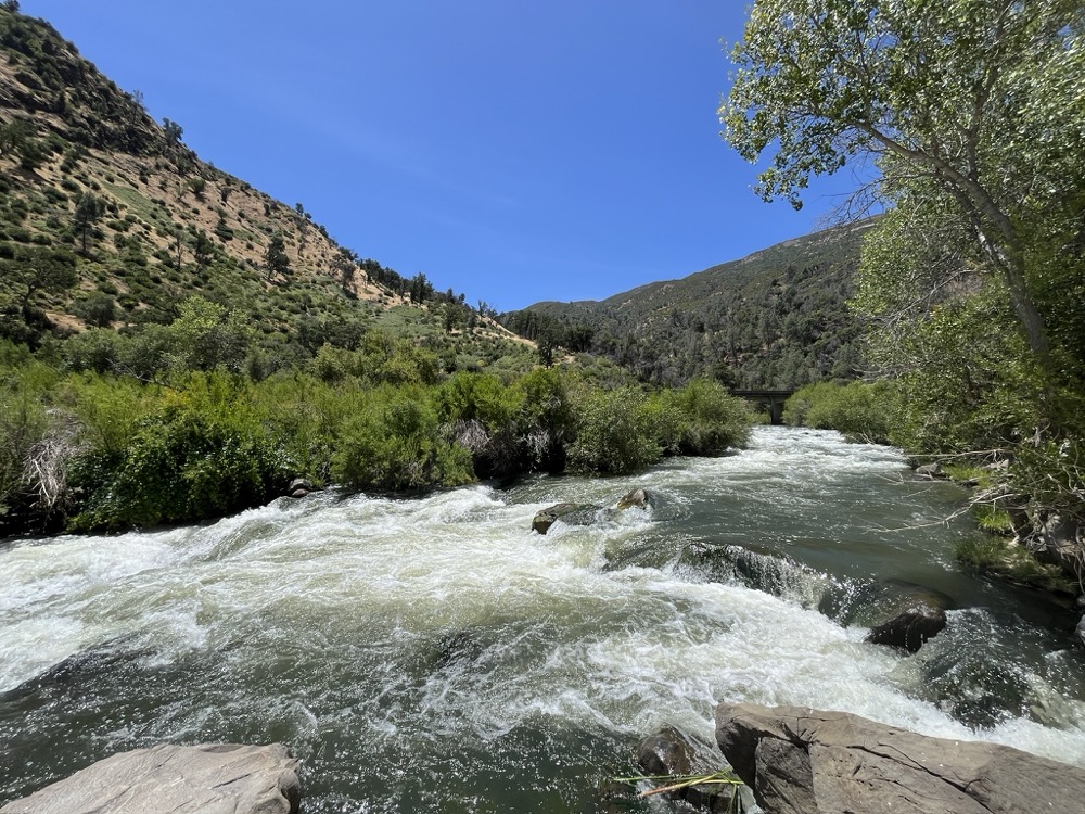
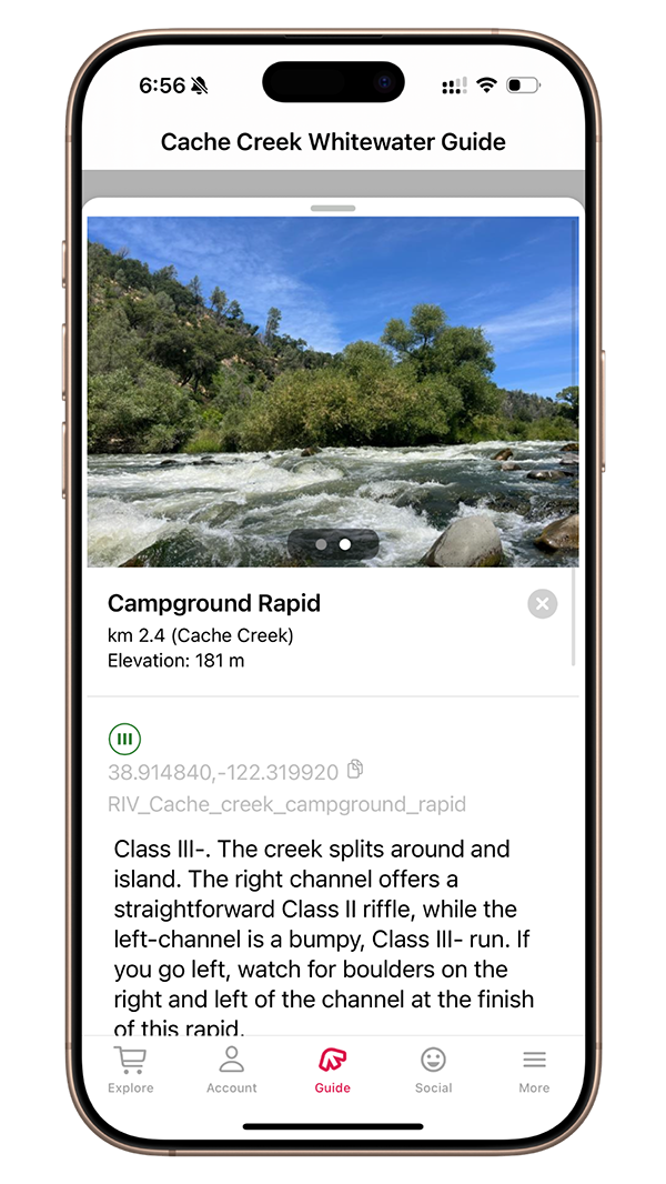
Mile 1.5 – Campground Rapid
Class III-. Cache Creek splits around and island. The right channel offers a straightforward Class II riffle, while the left-channel is a bumpy, Class III- run. If you go left, watch for boulders on the right and left of the channel at the finish of this rapid. Below this rapid is a big pool, a campground on the left, and unique geology on the right.
Mile 1.7 – Cache Creek Regional Park Middle Campground
River Left. Just downstream of Campground Rapid is a nice campground owned and operated by Yolo County. As of the most recent update from their website, the camping season has been postponed until further notice.
Mile 1.8 – Middle Camp Rapid
Class II. This is a read-and-run rapid, but be mindful of trees.
Mile 2.7 – Cache Creek Canyon Regional Park (Lower)
River Left. The Lower Day Use Area of Cache Creek Canyon has a fee, but offers great river access.
Mile 2.7 – Lower Cache Park Rapid
Class II. Watch out for a decent-sized wave on the left-hand side at the top of this rapid. It can be passed by entering center. Alternatively, run it, and watch out for duckies.
Mile 2.9 – County Road 40 Bridge
County Road 40 Bridge passes overhead, marking the coming of Joe’s Nemesis rapid. Enjoy Joe’s.
Mile 3.0 – Joe’s nemesis Rapid
Class II+/III-. This is a deceptively tricky rapid. Cache Creek splits around a tree island, with the left channel offering a better route. Enter on the inside right of the left channel, and stay inside to avoid a large rock on the bottom left of this rapid, which may come up faster than you think.
Mile 4.7 – Highway 16 Bridge
Highway 16 passes overhead. This means have arrived to Mother Rapid. If you’d like to scout Mother, there is a trail on the right. It can also be scouted during shuttle from a small gravel lot on the river left side of this bridge. Take the left channel of Mother.
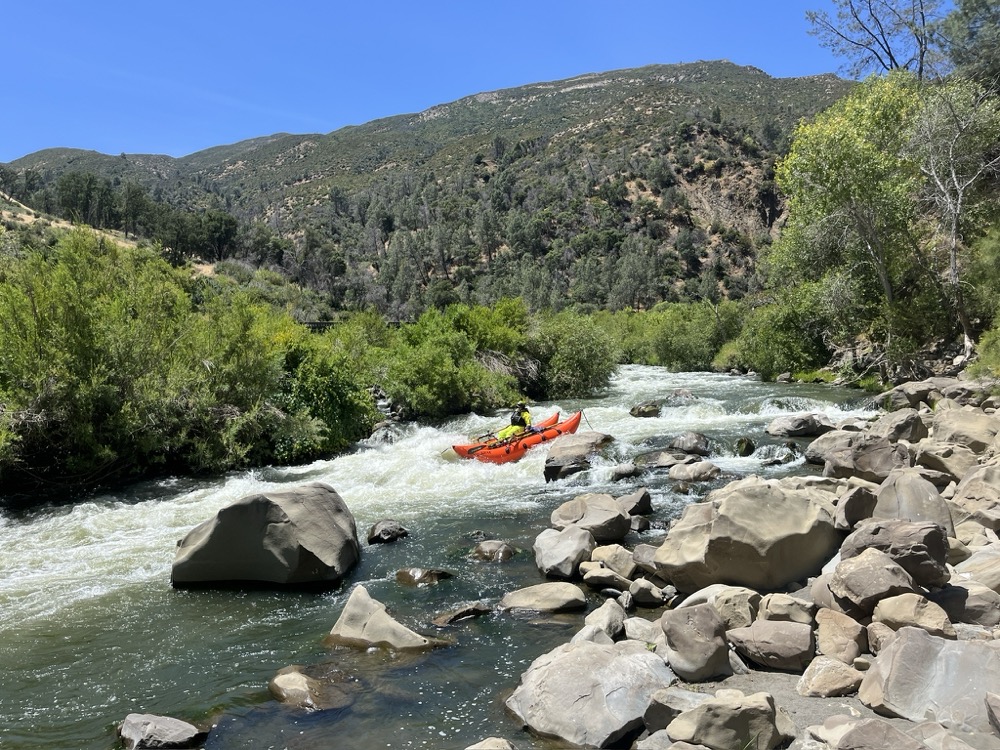
Mile 4.7 – Mother Rapid
Class III. Take the left channel below the bridge. The most commonly run line here is along the right side of the main (left) channel. You will have to dodge some rocks, but stay on the inside right of this channel. The river makes a quick right turn and then drops you into the main hole of Mother. Watch out for the boulders on the left. Below the main drop of Mother Rapid is a Class II rock garden
Mile 5.8 – Camp Haswell River Access
River Right. Camp Haswell can be a bit tricky to spot from river level, but it is a good spot for take-out.
It’s an old Boy Scout Camp and features a large parking lot, and usually a porta-potty during the summer months.
No camping allowed.