Rio Atirro
Paddling the Rio Atirro
Costa Rica Rivers
Rio Atirro
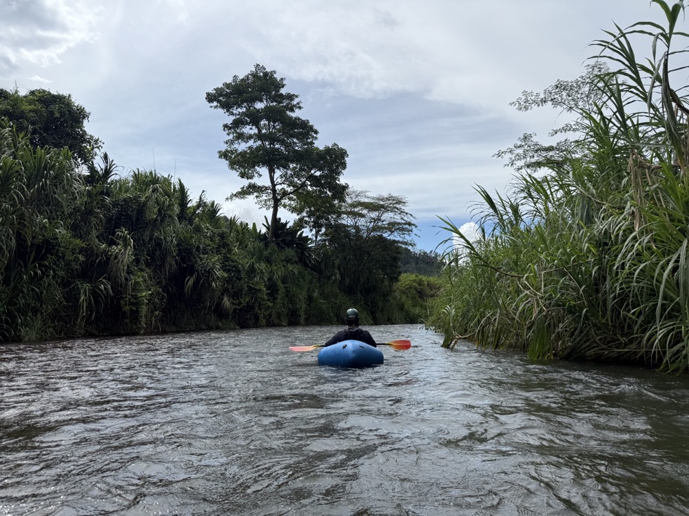
The Rio Atirro near Turrialba offers a very short and low-water packrafting experience. While it’s truly tiny and only navigable by packraft during certain flows, I’ve published this information because I believe it will be useful to anyone curious about attempting this run.
This guide is in BETA and has limited information. Do you have any information to share about the Rio Atirro? Click here to contribute.
About The Rio Atirro
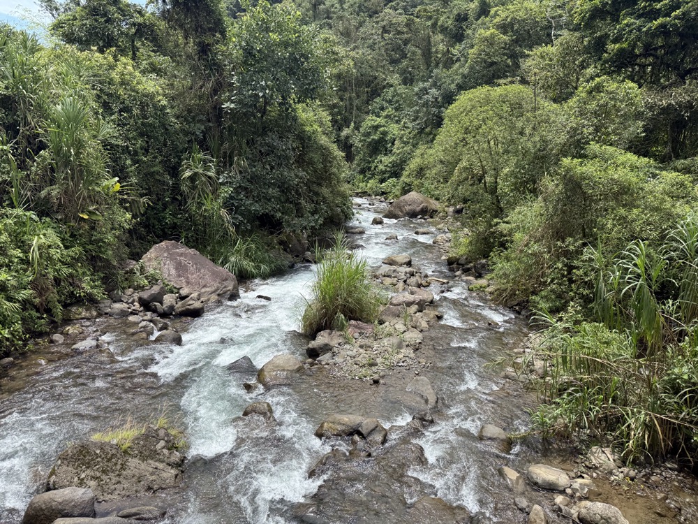
It starts off very steep and fast and then mellows out as the valley flattens out towards Lake Angostura.
Safety
Similar to the other rivers in the area, when it rains the water comes up very quickly. On our run we had to portage numerous times, deal with strainers, and of course it started raining.
Rio Atirro – Class III+ & IV
When we ran this I would estimate that we had approximately 75 CFS. Maybe 100, probably less. I wouldn’t want it any lower. I’m also not sure if I would want it any higher than 200 CFS. The river is pretty steep with some real drops and large boulders scattered in inconvenient places. There were strainers and other rock-nastiness, that would only come at you faster with more flow. But on this days run, even at less than 100 CFS, almost all of it was runnable.
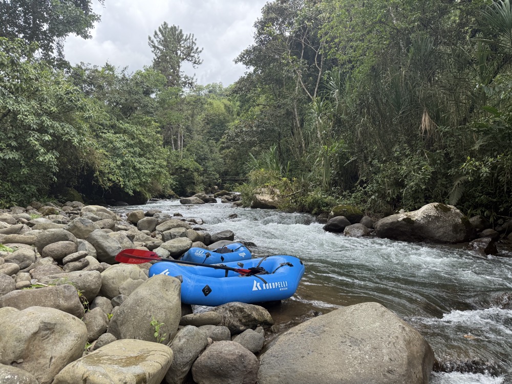
Kilometer 0 – Access
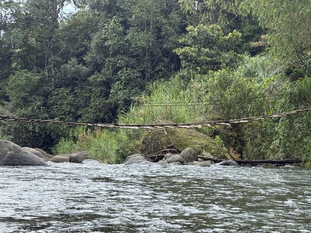
River Left. Just prior to the camping / lodging area “Quijote Experience” you’ll see a small trail that gets you to the water. You know you’re there if it takes you to a badly dilapidated footbridge.
Kilometer 0.1 – Portage
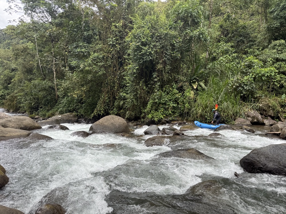
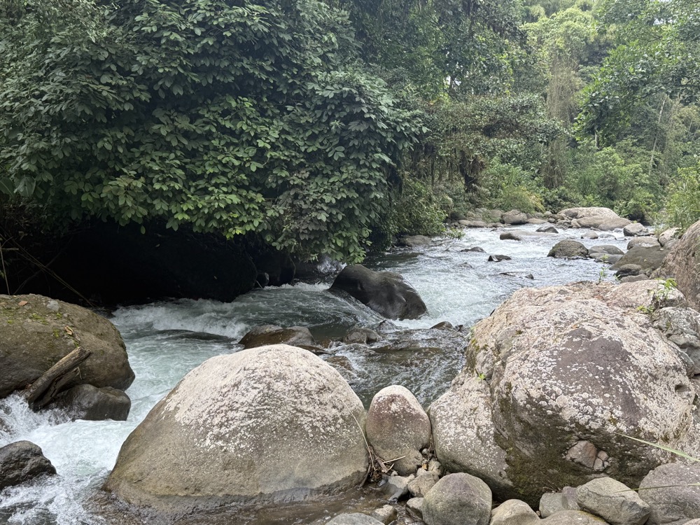
We made it 100 meters before we stopped, scouted and portaged. The beginning of the Rio Atirro has a lot of gradient. This rapid was a steep jumble of rocks that had a lot of entrapment possibilities.
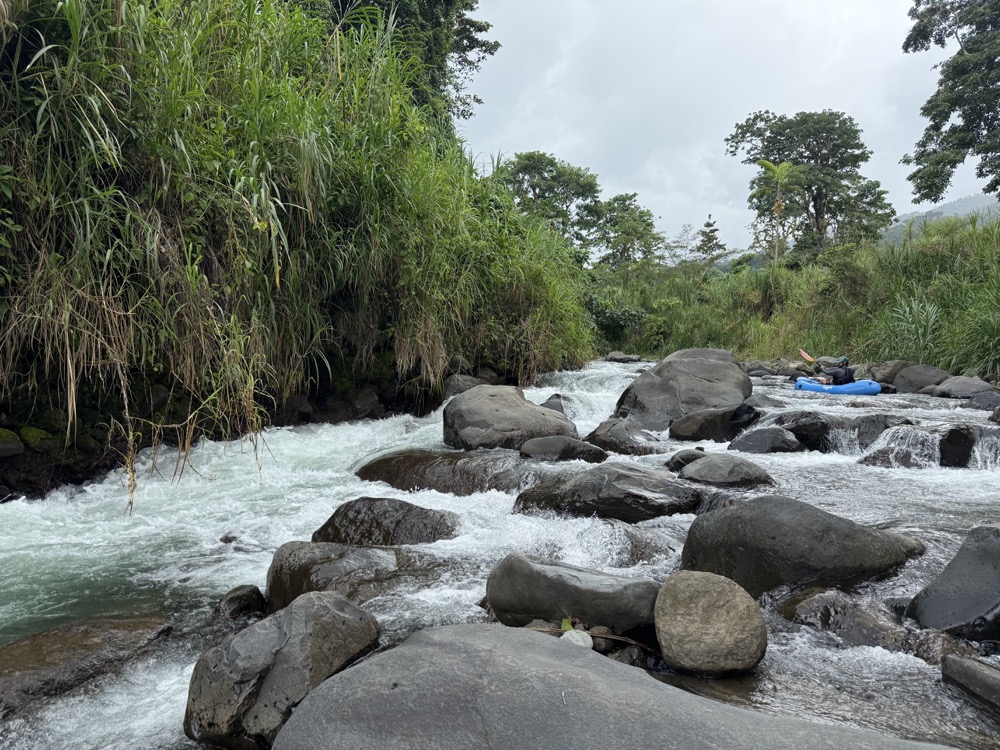
Lots of rapids
Tons of technical rapids with drops, tight slots to run and holes from here until Kilometer 3.7. We didn’t run anything blind that we couldn’t see through from top to bottom. This meant one of us scouted, in total probably half a dozen times, with a few portages. The portages I didn’t drop pins on, unfortunately, but they were obvious when we saw them.
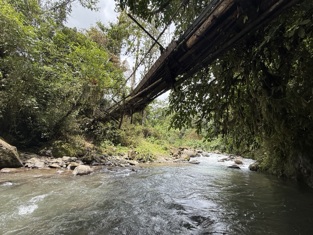
Kilometer 0.8 – Old bridge
Old foot bridge that’s coming apart is here.
Kilometer 1.2 – River splits
The river split around a very long island at this point. We went right. Floating on barely nothing now, we had to walk around one rapid as there just wasn’t enough water. The island is about 300 meters long.
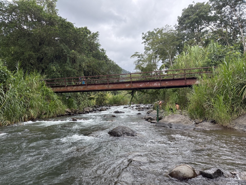
Kilometer 2 – Bridge and gauge
You’ll pass under a vehicle bridge, then spot a river gauge on the left bank. During our trip, the gauge read 80 centimeters. However, be aware that this is a repeating gauge where each meter repeats the measurement. So, if you return and see significantly more water but the gauge still reads 80 centimeters, it likely indicates a much higher level, such as 1.8 meters.
Kilometer 3.7 – Mellow river
Starting at this point, the river mellows out quite a bit and gets into Class II.
Kilometer 5.25 Ruta 225 Bridge
Kilometer 5.3 – Takeout
River Left. This is private property. We tried to takeout at the bridge but the terrain was too difficult. We asked the family that lives here if we could use their driveway to get to the road, and they were fine with it.
This guide is in BETA. Help this page by adding a waypoint
Do you know this run? Submit a waypoint below.